
Serving this area? Explore our digital marketing in Jacksonville IL.
We fly drones for businesses all over central Illinois, but Jacksonville is home, and every so often the camera comes up just for the love of the place. Over the past couple of years we’ve built up a little aerial library of the spots that make this town what it is: Lake Jacksonville on a calm day, the spillway running loud, the Ferris wheel turning over Community Park, and the memorial that reminds us who we owe it all to. This post gathers those flights in one place: a hometown tour of Jacksonville, IL from above, one landmark at a time.
Lake Jacksonville: The Town’s Backyard
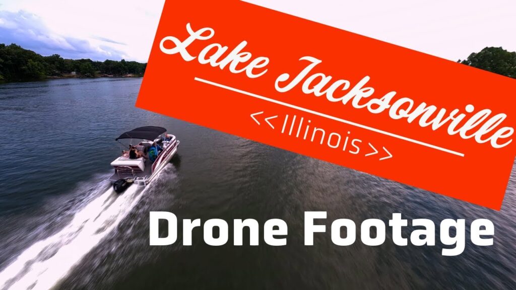
Start where every Jacksonville summer starts. Lake Jacksonville sits just southeast of town, and from the ground it’s a familiar patchwork: a boat ramp here, a campsite there, a cove you’ve fished a hundred times. From two hundred feet up, it becomes something else entirely: a long, branching stretch of blue framed in timber, with docks tracing the shoreline like stitching. The FPV footage above sweeps low across the water and up over the treeline, and if you grew up swimming, skiing or camping out there, we suspect it’ll hit you the same way it hit us in the edit bay.
Aerial views also make plain what makes the lake work as a destination: how much shoreline there actually is, how the camps tuck into the coves, and how close it all sits to town. It’s a five-minute drive that photographs like a getaway.
The Spillway: Where the Lake Lets Loose
Everybody in town knows the spillway. It’s where the lake spills its excess and turns into white noise you can feel in your chest. It’s also a spot you can really only appreciate from angles no person can stand. This flythrough chases the water over the edge and down the channel, close enough to catch the spray. It’s the kind of shot that shows off what drone videography does best: putting the camera in places that used to be impossible and making a familiar landmark feel brand new.
Community Park and the Ferris Wheel
Rise up from the corner of Main Street and Morton Avenue and Community Park unfolds beneath you: ball fields, walking paths, old-growth shade trees, and the landmark that makes this park unlike any other in Illinois, the Ferris wheel. Jacksonville isn’t just a town that has a Ferris wheel; it’s the home of the Eli Bridge Company, the family firm that’s been building Big Eli wheels here for over a century. Seeing one turn over its hometown park, from the altitude of the wheel itself, is about as Jacksonville as a photograph can get.
Every town has a park. Not every town has a park with a Ferris wheel built a few blocks away, and almost no one has seen theirs from the air.
Bonus Flight: Community Park in Time-Lapse
Same park, different trick. This one runs the FPV footage as a time-lapse, compressing the motion over the grounds into something closer to a hummingbird’s view of an afternoon. We include it here for a simple reason: it shows how much variety one location can yield. A single park produced a cinematic flyover and a kinetic time-lapse: two completely different pieces of content from the same acre of grass.
The World War II Memorial: Flown With Care
Not every flight is about spectacle. Jacksonville’s World War II memorial honors the local men and women who served, and the aerial perspective does something quietly powerful here: it shows the memorial in the context of the community it watches over. We flew this one slowly and deliberately, the way the subject deserves. Of everything in this roundup, it’s the footage we’re most careful with, and the one we most hope people outside Morgan County take a minute to watch.
Why We Keep Pointing Drones at Our Hometown
Part of it is practice. Every flight sharpens the flying. Part of it is portfolio. But mostly, it’s that drone photography in Jacksonville, IL keeps proving the same point we make to business owners every week: perspective changes how people feel about a place. The same is true of a storefront, a campus, a job site or an acreage going to auction.
- Familiar isn’t boring from above. Every landmark in this post is something locals pass daily, and every one of them looks remarkable from the air.
- Local footage travels. Hometown aerials get shared by people who’ve moved away, by community pages, by anyone who’s ever camped at the lake.
- The same lens works for business. The craft behind these flights is the same craft behind the auction properties we’ve filmed around Jacksonville and the storefronts, venues and job sites we shoot across the region.
- It’s home. We work with businesses right here in Jacksonville, and showing off the town is the best business card we own.
If your business, event or property sits anywhere in the Jacksonville area and you’ve wondered what it looks like from up there, our drone video services page covers how we plan, fly and deliver: FAA-certified, priced per project, and edited for wherever the footage needs to live.
See Your Corner of Jacksonville From Above
Storefronts, properties, events, land: if it’s worth showing off, it’s worth showing off from the air. FAA-certified drone photo and video, flown by the team that lives here.
FAA-certified • Based in Jacksonville, IL • From the team at Elevated Ideas
Good To Know
Jacksonville Drone Footage FAQs
Where were these drone videos filmed?
All around Jacksonville, Illinois: Lake Jacksonville and its spillway southeast of town, Community Park at Main Street and Morton Avenue (including its famous Ferris wheel), and the local World War II memorial. Every flight was flown by our FAA-certified team based right here in town.
Is it legal to fly drones over parks and lakes in Jacksonville?
Generally yes, under FAA Part 107 rules with proper airspace awareness, altitude limits and respect for people below. We check airspace before every flight, avoid crowds, and follow both federal rules and any local guidance, which is exactly what any business hiring a drone operator should expect of them.
Can I use this footage for my website or community page?
We love seeing the videos shared, and embedding the YouTube versions is always welcome. For licensed use of raw footage in websites, promotions or publications, just reach out; we keep the originals in high resolution and licensing is straightforward, and we quote it up front.
Do you shoot drone photography for Jacksonville businesses?
Yes. That is the day job. We fly aerial photo and video for storefronts, real estate, auctions, events, job sites and facilities across Jacksonville, Morgan County and the surrounding region, with everything planned around how the business will actually use the footage.
What does a local drone shoot cost?
Less than most people guess, especially in and around Jacksonville where travel is minimal for us. Every project is quoted flat and up front based on the location, the shots needed and the deliverables: aerial photos, edited video, social clips or all three. Tell us what you have in mind and we’ll put a number on it.