
Professional Drone Photography & Video That Sells Properties and Showcases Projects
Aerial photography that reveals property features buyers can't see from the ground. High-definition video walkthroughs that tell your story in seconds. 3D mapping and floor plans that show scale and layout with precision. All captured by FAA Part 107 certified operators with cinema-grade equipment. Drone footage that drives interest, engagement, and offers.
See Our Work Across Central Illinois
From Jacksonville storefronts to Springfield developments, Lake Springfield shorelines to rural acreage in Morgan County — here's what our drone services look like in action.
Business Photos & Fly-Throughs
The perfect way to show off your Central Illinois business inside and out. Whether you're a restaurant on the Jacksonville square, a manufacturer in Springfield, or a retail shop in Champaign — aerial and interior fly-throughs give customers a true feel for your space before they ever walk through the door. Great for Google Business Profiles, social media, and your website.
Commercial & Real Estate
Bare land or fully furnished — drone photos and video show it all perfectly. From 40-acre parcels in Morgan County to commercial developments along I-72, aerial footage captures the full scope of a property in ways ground-level photos never can. Realtors across Central Illinois use our drone services to sell listings faster and at higher prices.
Event Coverage
Record your event for memories or future promotion. Festivals, fundraisers, grand openings, outdoor weddings, sports events — aerial coverage adds a dimension that ground cameras simply can't match. We've captured events across the Springfield, Jacksonville, and Bloomington areas, delivering footage that's perfect for highlight reels, social media, and marketing materials.
Cinematic Production
Splice into your own creative ideas with help from our drone services. Need dramatic aerial B-roll for a commercial? Sweeping landscape shots for a brand video? Dynamic tracking shots for a promo? We provide raw cinematic footage or fully edited sequences that elevate any production. Based in Central Illinois and available for projects across the Midwest.
Why Drone Footage Is Essential for Modern Real Estate & Construction
A decade ago, drone footage was a luxury for high-end real estate. Today it's standard. Listings with drone photography and video get 68% more offers, sell 3-5 days faster, and command 5-10% higher prices than similar properties without aerial visuals. The reason is simple: buyers want to see the whole property -- the land, the surroundings, the neighborhood, the view from above -- all in a few seconds. They want to understand scale and context that ground-level photos can't convey. A property that looks average in static photos suddenly feels spacious, valuable, and desirable when aerial video shows the full lot, manicured landscaping, proximity to parks, or panoramic views. For real estate agents, drone footage isn't an optional upgrade anymore -- it's a competitive necessity.
Construction and development projects face a similar challenge. Clients, investors, and stakeholders need to see progress -- from site prep through foundation, framing, roof, and final details. Drone photography provides documentation that ground-level photos miss entirely. You see the full scope of the project, surrounding buildings and terrain, seasonal progress over time, and ultimately, a finished product that's impossible to evaluate from the ground alone. 3D mapping technology takes this further by creating detailed floor plans, volume calculations, and site surveys that inform decision-making with precision. Contractors who provide drone documentation to their clients gain credibility, reduce disputes about progress and scope, and position themselves as modern and professional.
The power of professional drone services extends beyond photography. Video tells a story. A two-minute cinematic aerial walkthrough of a property sells faster than a hundred static photos because it engages the viewer emotionally -- they visualize themselves living there, understand the neighborhood character, and develop genuine interest rather than passing curiosity. For events -- weddings, corporate gatherings, outdoor festivals -- drone video captures atmosphere and scale that ground-level footage completely misses. For developers, time-lapse drone footage over months or years tells the most compelling story of transformation and progress. Professional equipment, experienced pilots, and skilled post-production editing transform raw footage into marketing assets that drive outcomes.
Our Complete Drone Services Offering
Aerial Photography
High-resolution 20+ megapixel drone photography that showcases properties from above, revealing lot size, landscaping, surroundings, and context that ground-level photos miss. Perfect for real estate, development projects, construction progress, and any property where the full scope matters.
Cinematic Video Tours
Professional 4K video walkthroughs with smooth camera movements, color grading, music, and narration that tell the story of a property or project. These two to five minute videos engage viewers emotionally and drive significantly more offers than static photos alone.
3D Mapping & Floor Plans
Drone-based 3D mapping creates detailed site surveys, orthomosaic images, volume calculations, and precise floor plans. Used for construction estimates, development planning, insurance documentation, and detailed property analysis.
Progress Documentation
Time-lapse and sequential drone photography that documents construction progress, seasonal changes, or development timelines. Perfect for showing investors, clients, and stakeholders exactly what's been accomplished and what's coming next.
Professional Post-Production
We handle all editing -- color correction, audio mixing, motion graphics, subtitles, and custom branding. Raw footage becomes polished marketing assets you're proud to show prospects, investors, and clients.
Event Coverage
Aerial video coverage for weddings, corporate events, outdoor festivals, real estate open houses, and special occasions. Drone footage captures atmosphere and scale that ground-level videography can't match.
Rapid Turnaround Delivery
We understand your timeline matters. Most projects are delivered within 3-5 business days with options for expedited 24-48 hour turnaround when you need fast results for active listings or time-sensitive campaigns.
How We Execute Your Drone Project
Project Planning
We meet to understand your goals, timeline, and vision. Are we showcasing a property for sale, documenting construction progress, creating an event highlight reel, or capturing a development project? We confirm logistics, location, weather windows, and any special requirements.
Flight Planning & Permits
Our FAA Part 107 certified pilots plan flight paths, confirm airspace clearance, coordinate with local authorities if needed, and prepare equipment. We handle all regulatory compliance so you can focus on your business.
Professional Capture
On shoot day, we arrive with cinema-grade drone equipment, multiple batteries, and backup systems. We capture raw footage from multiple angles and altitudes -- establishing shots, detail shots, movement sequences -- to give the editor maximum flexibility in post-production.
Post-Production & Editing
We review raw footage, select the best takes, color grade for cinematic look, add audio and music, include any titles or graphics, and create multiple versions optimized for different platforms -- 4K for your website, 1080p for social media, vertical formats for mobile.
Client Review & Revisions
You get a private link to review the edited video. We make revisions based on your feedback until you're completely satisfied. You own the final files and can use them everywhere.
Delivery & Optimization
We deliver final files in multiple formats optimized for different uses -- high-resolution files for archival, social media optimized versions for instant sharing, embedding code for your website, and guidance on how to maximize views and engagement across platforms.
Why Agents & Developers Choose Us for Drone Services
FAA Certified & Insured
All our pilots hold FAA Part 107 certifications and maintain full insurance coverage. We handle compliance and permits so you can focus on your business without legal or liability risk.
Cinema-Grade Quality
We don't use consumer drones or amateur operators. Our equipment is professional-grade, our pilots are experienced, and our post-production process is meticulous. The result looks polished and premium.
Fast Turnaround
Most projects deliver within 3-5 business days. We understand your real estate market moves fast and construction projects have tight timelines. Quick delivery means your footage goes to market when it matters most.
Transparent Pricing
No hidden fees. Project pricing is based on scope, location, complexity, and timeline. We quote upfront so you know exactly what you're getting and what it costs.
What Our Clients Say
Recent Drone Projects
Real aerial photo and video shoots we’ve flown for businesses, events and properties across Springfield, Jacksonville and Central Illinois. Tap any project to see the full story.
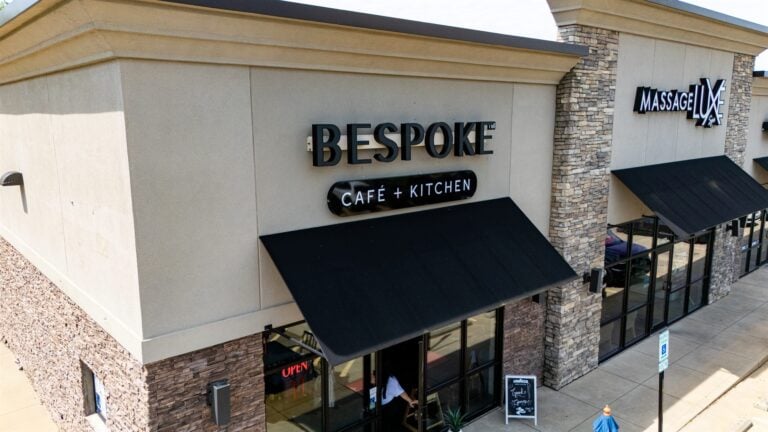
Bespoke Café + Kitchen
View project →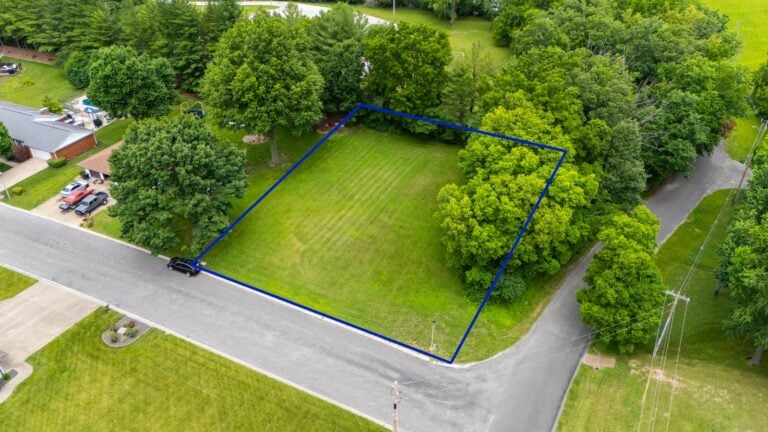
Spradlin Auction & Real Estate
View project →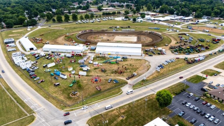
Morgan County Fair 2025
View project →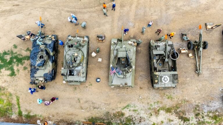
Military Tank Show — FPV
View project →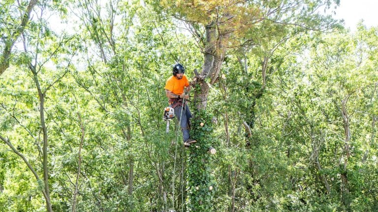
T&K Tree Service Removal
View project →
Lady Bandits Brew & Boutique
View project →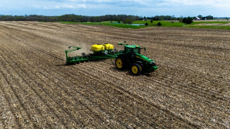
Spring Planting Season
View project →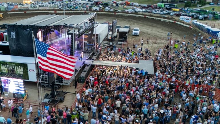
Dustin Lynch Concert
View project →Drone Services Questions -- Answered
Ready to Capture Stunning Aerial Footage?
Get a free drone consultation where we'll discuss your property, project, or event, assess what aerial photography and video could accomplish for you, explain our process and pricing, and answer all your questions about how professional drone services work. We'll show you examples of recent projects and demonstrate exactly how drone footage drives offers, accelerates sales, or showcases projects. No obligation, no pressure -- just a conversation about capturing your best angle.
Or call us directly: (217) 724-8153