
Local to the area? Explore our video marketing in Springfield IL.
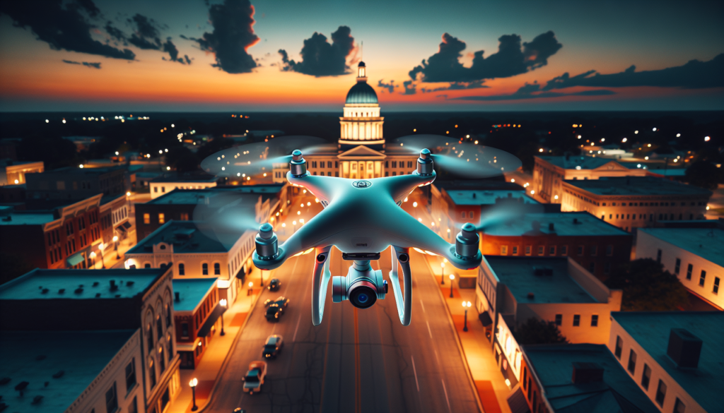
If you own a business in Springfield, Illinois, your customers are making decisions about you before they ever walk through your door. They’re scrolling your website, checking your Google Business Profile, and scanning your social media. The question is: what do they see? Blurry smartphone photos taken in bad lighting? Or stunning, professional drone photos in Springfield IL that make your business look like the clear choice?
Aerial photography and video have gone from a luxury reserved for Hollywood productions to one of the most powerful, affordable marketing tools available to local businesses. Whether you’re a real estate agent listing lakefront properties on Lake Springfield, a contractor documenting a build along Dirksen Parkway, or an event organizer promoting the Illinois State Fair, drone photography in Springfield Illinois gives your business a perspective that ground-level photos simply cannot match.
Here’s the reality: businesses with professional photos on their Google Business Profile receive 42% more requests for directions and 35% more clicks to their website. Now imagine the impact when those photos are breathtaking aerial shots that showcase your property, your event, or your work from angles your competitors can’t replicate. That’s not just marketing — that’s a competitive advantage.
The Aerial Perspective: Why It Matters
Ground-level photos tell one story. Aerial photos tell the complete story. When a potential customer sees your business from above, they instantly grasp the scale, the location, the surroundings, and the professionalism of your operation. It’s the difference between reading a map and seeing the territory.
“A single drone photo communicates more about your business’s scope and professionalism than a dozen ground-level smartphone shots ever could.”
Think about what an aerial perspective reveals that ground photos miss: the size of your lot, your proximity to major roads and landmarks, the layout of your facilities, the surrounding neighborhood, and the overall curb appeal of your property from an angle that makes people stop scrolling. For Springfield businesses specifically, aerial shots capture the beauty of the city’s tree-lined streets, the expanse of Lake Springfield, and the energy of downtown — context that makes your listing stand out in a sea of forgettable ground-level images.
This isn’t about vanity. It’s about trust. When someone searches for a service and sees one business with professional aerial imagery and another with phone snapshots, the business with drone content wins the click every single time. The aerial perspective signals investment, professionalism, and confidence in your brand.
Industries That Benefit From Drone Photography
Nearly every industry in Central Illinois can leverage aerial video and photography, but some see an outsized return on investment:
- Real Estate — Listings with aerial photos sell 68% faster than those without. For lakefront properties on Lake Springfield or homes in upscale neighborhoods like Leland Grove, drone flyovers showcase lot size, waterfront access, and neighborhood context that buyers need to see
- Construction & Development — Progress monitoring from the air documents every phase of a build. Contractors along Dirksen Parkway and throughout Sangamon County use regular drone flyovers to update clients, settle disputes, and create compelling portfolio content
- Agriculture — Sangamon County’s agricultural operations benefit from aerial crop surveys, field mapping, and documentation of farming operations. We covered this extensively in our blog about drone crop spraying in Central Illinois
- Events & Festivals — From the Illinois State Fairgrounds to outdoor weddings at venues around Springfield, aerial event coverage captures crowd scale, venue layouts, and cinematic moments that ground cameras miss entirely
- Tourism & Hospitality — Hotels, campgrounds, and recreational facilities need aerial content to show prospective visitors what to expect. Our work with Buena Vista Campgrounds demonstrated exactly how drone video transforms a hospitality listing
- Retail & Restaurants — Downtown Springfield businesses can showcase their storefronts, patios, parking availability, and neighborhood charm with aerial shots that drive foot traffic
How Drone Content Boosts Your Online Presence
Professional drone photos Springfield IL businesses use don’t just look impressive — they produce measurable marketing results across every digital channel:
Google Business Profile Impact
Google’s algorithm favors profiles with high-quality, original photography. Aerial photos are inherently unique — no stock photo library has a drone shot of your specific property. Adding professional drone images to your Google Business Profile increases engagement, drives more direction requests, and improves your local search ranking. Remember: 42% more direction requests come from profiles with professional photos versus those without.
Website Conversions
Your website has approximately 3 seconds to make a first impression. A hero banner featuring a cinematic aerial shot of your business instantly communicates professionalism and scale. Websites with professional photography see conversion rates up to 40% higher than those using stock images or amateur photos. Drone imagery takes this even further by providing a perspective visitors have never seen.
Social Media Engagement
Aerial content consistently outperforms ground-level photos on social media. Drone videos on Instagram Reels, Facebook, and TikTok generate significantly higher engagement rates because the perspective is inherently eye-catching. People share aerial content because it’s visually stunning — and every share extends your reach to potential customers who’ve never heard of your business.
Springfield IL Drone Photography Use Cases
Springfield and the surrounding Sangamon County area offer unique opportunities for drone photography Springfield Illinois businesses can leverage:
- Lake Springfield Properties — Waterfront real estate demands aerial photography. Drone flyovers capture dock access, shoreline frontage, water proximity, and the stunning natural setting that makes lakefront living so desirable. A ground-level photo of a lakefront home shows a house. An aerial photo shows a lifestyle
- State Fairgrounds Events — The Illinois State Fairgrounds host dozens of events annually. Aerial coverage captures crowd density, vendor layouts, and the sheer scale of events in ways that ground photography simply cannot achieve
- Downtown Springfield Businesses — Capitol district restaurants, boutiques, and professional offices benefit from aerial shots that showcase their proximity to landmarks, parking access, and the vibrancy of downtown
- Dirksen Parkway Development — Construction projects, new builds, and commercial development along Springfield’s busiest corridors need regular aerial documentation for progress reports, marketing materials, and stakeholder updates
- Agricultural Operations in Sangamon County — From crop monitoring to farmstead documentation, agricultural drone photography provides operational data and marketing imagery that ground-level cameras cannot capture
- Residential Neighborhoods — New housing developments, luxury listings, and neighborhood overviews help real estate agents market entire communities, not just individual properties
Types of Drone Shots That Sell
Not all drone photography is created equal. Professional aerial video Central Illinois business owners invest in includes several distinct shot types, each serving a different marketing purpose:
- Aerial Establishing Shots — Wide, sweeping views that show your business in context with its surroundings. These shots establish location, scale, and neighborhood character. Perfect for website hero banners and Google Business Profile cover photos
- FPV Cinematic Shots — First-person-view drone footage creates immersive, dynamic video that flows through and around structures. FPV shots feel cinematic and are ideal for social media content and video marketing campaigns. This is the type of content that goes viral
- Property Flyovers — Smooth, orbiting flights around a property showcase every angle and provide a comprehensive visual tour. Essential for real estate listings, hospitality venues, and commercial properties
- Progress Monitoring — Regularly scheduled aerial documentation of construction sites, renovations, or land development. These time-stamped images create a visual timeline that’s invaluable for client reporting and portfolio building
- Event Coverage — Dynamic aerial footage capturing the energy, scale, and layout of events from above. Combined with ground-level footage, this creates compelling highlight reels that event organizers use for promotion year after year
- Overhead/Top-Down Shots — Bird’s-eye views looking straight down, perfect for showcasing property layouts, parking lots, outdoor seating areas, and land parcels
“The businesses that invest in professional drone content today are building a visual library that will generate leads for years to come. Every aerial shot is a long-term marketing asset.”
Professional Drone Content vs. Smartphone Photos: The ROI
Let’s talk numbers. You might be thinking, “My iPhone takes great photos — why would I pay for drone photography?” Here’s why the math doesn’t lie:
- Smartphone photos are taken from 5 feet off the ground, in whatever lighting happens to be available, with a lens optimized for selfies and snapshots. They’re fine for personal use. They are not fine for marketing a business you’ve invested thousands (or millions) of dollars into
- Professional drone photos are captured from optimized altitudes and angles, during ideal lighting conditions, by a certified pilot using commercial-grade equipment with sensors and lenses designed for professional imagery
- The cost comparison — A professional drone photography session typically runs between $200 and $800 depending on scope. That same investment in paid advertising might get you a few days of Facebook ads. But the drone content lives on your website, Google profile, and social media indefinitely, generating impressions, clicks, and leads for months or years
- Perceived value — Businesses with professional aerial imagery are perceived as more established, more successful, and more trustworthy. For service-area businesses competing in Springfield and Central Illinois, that perception directly influences which business gets the call
“A $400 drone shoot generates content that can drive tens of thousands of dollars in business over its lifetime. Try getting that return from a smartphone.”
Drone Content and Local SEO
If you’re working on improving your local search ranking — and every Springfield business should be — drone photography is a powerful but underutilized tool in your SEO strategy:
- Google Business Profile photos are a direct ranking factor. Google rewards profiles with frequent, high-quality, original photo uploads. Drone images are inherently original and signal an active, professionally managed listing
- Image search visibility — Properly optimized aerial photos (with geo-tags, alt text, and descriptive file names) appear in Google Image search, driving additional traffic to your website and profile
- Reduced bounce rate — Websites with compelling visual content keep visitors on page longer. Longer session duration tells Google your content is valuable, which improves your search ranking
- Social signals — When people share your aerial content on social media, it creates backlinks and social signals that contribute to your overall domain authority
- Content differentiation — In a market where most competitors use the same smartphone photos or stock images, drone content makes your listings visually distinct in search results, driving higher click-through rates
Combined with a comprehensive Google Business Profile management strategy, professional drone photography can meaningfully accelerate your local SEO performance.
FAA Part 107: Why Certification Matters
Flying a drone for commercial purposes in the United States requires an FAA Part 107 Remote Pilot Certificate. This isn’t optional — it’s federal law. Here’s why this matters for your business:
- Legal compliance — Using an uncertified drone operator for commercial photography exposes your business to potential FAA fines of up to $32,666 per violation. If an accident occurs, liability falls on both the operator and the business that hired them
- Safety knowledge — Part 107 certified pilots understand airspace classifications, weather minimums, operating limitations, and emergency procedures. Springfield’s proximity to Abraham Lincoln Capital Airport (SPI) means controlled airspace authorization is frequently required
- Insurance requirements — Professional drone operators carry aviation liability insurance. Amateur drone users typically don’t. If a drone causes property damage or injury during your shoot, you want to know the operator is insured
- Quality assurance — Certified pilots have invested in their craft professionally. They understand composition, lighting, flight planning, and post-production — skills that produce dramatically better results than a hobbyist with a consumer drone
“Elevated Ideas is FAA Part 107 certified, fully insured, and experienced in navigating Springfield’s airspace requirements. Every flight we conduct is legal, safe, and professionally executed.”
Real Results: Elevated Ideas Drone Work
At Elevated Ideas, drone photography and video aren’t theoretical — they’re a core part of the marketing solutions we deliver to Central Illinois businesses:
- Buena Vista Campgrounds — We produced a comprehensive drone video showcasing Buena Vista Campgrounds that transformed their online presence. The aerial footage captured the sprawling grounds, waterfront access, and recreational facilities in a way that ground photos never could. The result? A dramatic increase in booking inquiries and social media engagement
- Droneception — Our Droneception blog series explored the intersection of drone technology and agriculture in Central Illinois, documenting how aerial technology is transforming farming operations across Sangamon County. This content demonstrated the practical, non-marketing applications of drone technology
- Real Estate Clients — We’ve delivered aerial photography packages for residential and commercial real estate listings throughout Springfield, providing agents with the visual assets they need to close faster and at higher prices
- Construction Documentation — Regular aerial progress reports for contractors give project managers a bird’s-eye view of development milestones, helping maintain timelines and communicate progress to stakeholders
Every project reinforces what we’ve seen consistently: businesses that invest in professional drone content see measurable improvements in engagement, inquiries, and conversions.
When to Hire a Drone Photographer vs. DIY
Consumer drones have become more accessible, which leads many business owners to wonder: should I just buy a drone and do it myself? Here’s an honest breakdown:
DIY Might Work If…
- You only need occasional informal aerial shots for social media stories
- You’re willing to invest time in learning Part 107 regulations and passing the certification exam
- You operate exclusively in uncontrolled airspace (Class G) away from airports
- You’re comfortable with the learning curve and risk of crashing a $1,000+ drone
Hire a Professional When…
- The content will represent your business publicly — website, Google listing, advertising, or print materials
- You need cinematic-quality video with professional color grading and editing
- You’re flying near Springfield’s controlled airspace and need LAANC authorization
- You want FPV footage, night shots, or specialized aerial perspectives
- You need liability insurance coverage for the flight operation
- Your time is better spent running your business than learning to fly a drone
For most Springfield business owners, hiring a professional drone photographer isn’t just more convenient — it’s more cost-effective when you factor in equipment costs ($2,000-$10,000 for commercial-grade drones), certification time, insurance, software, and the opportunity cost of your time. A professional delivers polished, ready-to-use content in a single session.
Related reading: Event drone coverage in action — Morgan County Fair 2025: Photos, Drone Footage & Full Recap.
Ready to Elevate Your Business?
Professional drone photos and video give Springfield businesses a marketing advantage that competitors using smartphone photos simply cannot match. Let’s talk about what aerial content can do for your brand.
FAA Part 107 certified — fully insured — serving Springfield, Sangamon County, and all of Central Illinois.
COMMON QUESTIONS
Drone Photography FAQ
How much do drone photos cost in Springfield IL?
Professional drone photography sessions in Springfield typically range from $200 to $800 depending on the scope of the project, number of locations, and deliverables required. A basic real estate aerial package might include 10-15 edited aerial photos, while a comprehensive business marketing package could include aerial photos, cinematic video, and edited social media content. Compared to the ongoing cost of paid advertising, drone content provides exceptional long-term value since the assets can be used across your website, Google Business Profile, and social media indefinitely.
Do you need FAA certification for drone photography?
Yes. Any drone flight conducted for commercial purposes in the United States requires the pilot to hold an FAA Part 107 Remote Pilot Certificate. This applies to all paid drone photography and videography, including real estate photos, business marketing content, event coverage, and construction documentation. Flying commercially without Part 107 certification can result in fines up to $32,666 per violation. Elevated Ideas is fully Part 107 certified and insured, ensuring every flight we conduct is legal and safe.
What industries benefit most from drone video?
Real estate sees the most immediate ROI, with aerial listings selling 68% faster on average. Construction and development companies benefit from regular progress documentation. Agriculture operations use drone imagery for crop monitoring and field mapping. Event organizers and tourism businesses leverage aerial coverage to promote venues and experiences. Retail and restaurant businesses use drone content to showcase location advantages, parking, and surrounding amenities. Essentially, any business with a physical location or outdoor operations can benefit from professional aerial content.
Can drones fly near Springfield’s airport?
Springfield’s Abraham Lincoln Capital Airport (SPI) creates controlled airspace that requires specific authorization for drone flights. Professional Part 107 pilots use the LAANC (Low Altitude Authorization and Notification Capability) system to obtain real-time airspace authorization from the FAA. This process is routine for certified pilots but unavailable to recreational flyers. Elevated Ideas regularly obtains LAANC authorization for flights throughout Springfield’s airspace, ensuring full legal compliance.
How long does a drone photography session take?
Most single-location drone photography sessions take 1 to 2 hours on-site, including setup, multiple flight passes at different altitudes and angles, and equipment breakdown. Complex projects involving multiple locations, cinematic video production, or construction documentation may require additional time. Weather is always a factor — high winds, rain, or low visibility can require rescheduling. Edited deliverables are typically ready within 3 to 5 business days after the shoot.
What’s the difference between regular drone shots and FPV footage?
Standard drone photography uses GPS-stabilized drones that hover and move smoothly to capture steady aerial photos and video. FPV (First-Person View) drone footage uses smaller, more agile drones piloted through goggles, creating dynamic, cinematic movements that can fly through spaces, orbit structures at speed, and produce Hollywood-style action footage. FPV content is particularly effective for social media marketing where eye-catching, fast-paced video drives engagement and shares.
Do drone photos actually help with Google rankings?
Yes, in multiple ways. Google Business Profile listings with high-quality, original photos receive 42% more direction requests and 35% more website clicks. Google’s algorithm favors profiles with frequent photo uploads, and aerial photos are inherently unique content that signals an active, professionally managed listing. On your website, properly optimized drone images with geo-tags, alt text, and descriptive file names can appear in Google Image search results, driving additional organic traffic. The visual quality also reduces bounce rates, which is another positive ranking signal.
Is it worth buying my own drone for business photos?
For most business owners, hiring a professional is more cost-effective than DIY. A commercial-grade drone costs $2,000 to $10,000, plus you need Part 107 certification (study time and exam fee), liability insurance, editing software, and ongoing practice to develop piloting skills. A professional drone photographer brings all of this plus years of experience in composition, lighting, and post-production. Unless you plan to fly multiple times per month, the math favors hiring a certified professional who delivers polished, ready-to-use content.
Written by Ryan Mason, Founder of Elevated Ideas — FAA Part 107 certified drone pilot and digital marketing strategist serving Springfield IL, Sangamon County, and Central Illinois businesses. Last updated March 2026.