
Want local help with this? Explore our digital marketing in Jacksonville IL.
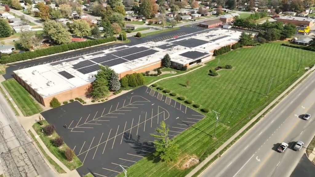
The day a solar array goes live is the day most of it disappears from view. Panels end up on rooftops nobody climbs and in ground fields nobody walks, which means the owner who just made a six-figure energy investment often never actually sees what they bought. When Bound To Stay Bound Books in Jacksonville, Illinois added solar to their operation, we flew the whole installation with a drone: rooftop and ground arrays, the full facility, and the property around it. The result is a complete aerial record of the system, and a look at why solar panel drone inspection is becoming standard practice for commercial arrays across central Illinois.
A Jacksonville Institution Goes Solar
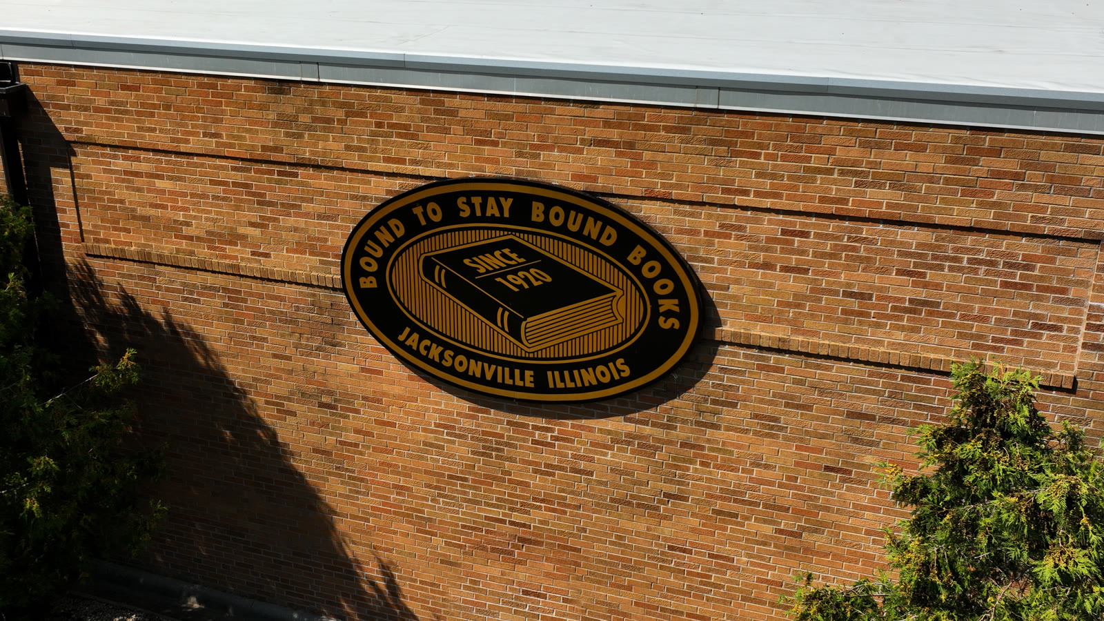
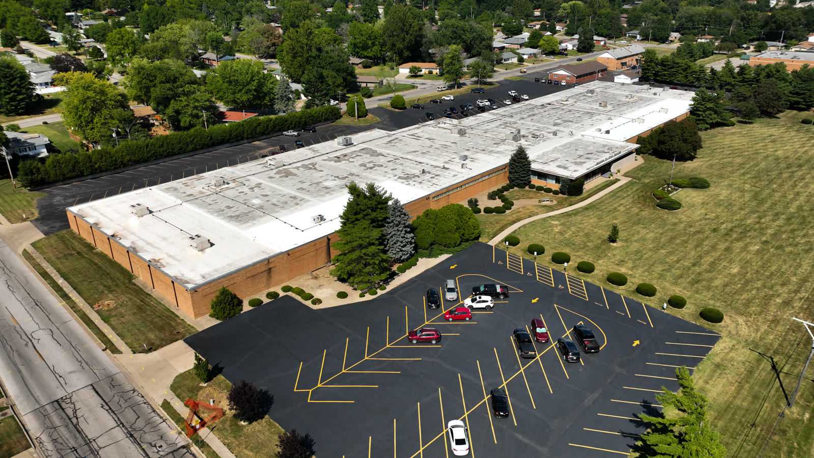
If you grew up around Jacksonville, you know the name on the building. Bound To Stay Bound Books is one of the city’s long-standing institutions (the sign on the brick reads “Since 1920”), binding and supplying durable books for school and public libraries across the country. It’s a big operation with a big footprint: a long production facility, acres of roof, and the kind of steady daytime power draw that makes commercial solar pencil out.
After the installation was complete, BTSB needed what almost no solar owner has: clear, current imagery of the entire system. Not a diagram from the installer’s proposal. The real thing, in place, from above.
Why Solar Panel Drone Inspection Starts on Day One
Most people hear “inspection” and think of finding problems years down the road. But the most valuable flight in a solar array’s life is the very first one, the post-install documentation flight, because it creates the baseline everything else gets compared against.
- A visual as-built record: exactly how many panels went in, where every string sits, and how the layout relates to the roof and grounds, useful for insurance, warranty claims and future service calls.
- Day-one condition: high-resolution aerial photos capture the panels clean and undamaged, so hail claims, installer disputes or degradation questions later have something concrete to point to.
- Shading and obstruction context: from altitude you can see tree lines, rooftop units and neighboring structures in relation to the array, the things that quietly cost production over time.
- Safe access to unreachable views: nobody has to walk a membrane roof or climb around racking; the drone covers rooftop and ground arrays in a single visit.
You can’t manage what you can’t see, and almost nobody can see their own solar array without a drone.
From Documentation to Promotion
Here’s the part that surprises most commercial property owners: the same flight that documents the system also produces some of the best marketing footage a business can own. The promo cut above turns the technical record into a story: a Jacksonville company investing in its own future, told in sweeping aerials that no ground camera could capture.
For the business, that’s content for the website, social channels and community announcements. For the solar installer, it’s a finished-project showcase that sells the next array better than any brochure. One solar installation drone shoot, two completely different jobs done.
What a Solar Installation Drone Shoot Delivers
- Full-array aerial stills: rooftop and ground-mount coverage, wide establishing shots and close panel-level detail.
- Documentation video: a methodical pass over the entire system for records, insurance and stakeholder reporting.
- A promo edit: a short, social-ready cut that celebrates the investment and works for both the owner and the installer.
- Facility context: the building, grounds and surroundings in frame, the same commercial drone photography a business can reuse across its website and print materials.
Who Puts This Footage to Work
Three groups get lasting value from a flight like this. Property owners get proof of what was installed and a baseline for every future insurance or warranty conversation. Solar installers get portfolio content that closes commercial deals. And facility managers get a repeatable way to check the array without renting a lift: fly it again next year, compare against the baseline, done.
It’s the same principle behind the rest of our aerial work: match the flight to how the imagery will actually be used. That’s how a golf car dealership in Taylorville ended up with a one-take facility tour, and how a Springfield café’s grand opening became a marketing library. For BTSB, the job was a permanent aerial record of a serious energy investment, and footage worth showing off while we were at it.
Need Eyes on Your Solar Investment?
FAA-certified drone documentation for solar arrays, rooftops and commercial facilities across central Illinois: baseline records, inspection flights and promo footage from a single visit.
FAA-certified • Documentation + promo packages • From the team at Elevated Ideas
Good To Know
Solar Drone Documentation FAQs
What is a solar panel drone inspection?
It is an aerial survey of a solar array using a drone: high-resolution photos and video of every panel, the racking, and the surrounding roof or grounds. It replaces climbing on roofs or walking ground fields, covers the entire system in a single visit, and produces imagery detailed enough to spot damage, debris and layout issues from the office.
Why document a brand-new solar installation?
Because the day-one flight creates your baseline. If hail hits, a warranty question comes up, or production drops in year three, you have dated aerial imagery showing exactly what was installed and what condition it was in. Without a baseline, every future claim becomes your word against someone else’s.
How often should a commercial array be flown after install?
An annual flight is a sensible rhythm for most commercial arrays in Illinois, plus an extra flight after major hail or wind events. Each pass gets compared against the baseline documentation, so changes in panel condition or new shading from tree growth are easy to spot year over year.
Can the footage really be used for marketing too?
Yes, and it should be. Going solar is a story customers and communities respond to, and aerial footage is the only way to show the scale of the commitment. The same shoot that produces the documentation record also yields a promo cut for the owner’s website and social channels, and portfolio content for the installer.
Is it legal to fly a drone over a commercial property for this?
Yes, when the pilot holds an FAA Part 107 remote pilot certificate and follows airspace rules. Elevated Ideas flies FAA-certified, coordinates any required authorizations, and plans every flight around the property and its neighbors, so owners get complete aerial records without compliance concerns.