
Want local help with this? Explore our digital marketing in Jacksonville IL.
When a piece of land goes up for sale or auction, the listing photos do most of the selling before a single buyer ever sets foot on the property. That’s exactly why real estate drone photography has become one of the most powerful tools an auctioneer, broker or land seller can use. Recently, Elevated Ideas was hired to capture a set of vacant commercial and residential development lots for Spradlin Auction & Real Estate in Jacksonville, Illinois, and we added custom property-line overlays so buyers could see exactly what they were bidding on, right down to the boundary. Here’s a look at the project, the techniques behind these aerial photos, and why drone photography sells land faster.
Why Real Estate Drone Photography Sells Land Faster
Vacant land is one of the hardest things to photograph from the ground. A standard photo of an empty lot is just… grass and trees. It gives a buyer no sense of the parcel’s size, its shape, where the boundaries fall, or what surrounds it. Drone photography for real estate solves all of that in a single frame. From a few hundred feet up, an aerial photo instantly communicates scale, access, road frontage, neighboring properties and the lay of the land: the exact information a serious buyer needs before making an offer.
The data backs it up: listings that use aerial photography consistently attract more clicks, longer engagement and faster sales than those relying on ground photos alone. For raw land, vacant lots and commercial parcels, that advantage is even bigger, because there’s simply no other way to tell the full story of a property. When you’re marketing dirt, perspective is the product, and nothing delivers perspective like a drone.
The Project: Aerial Photos for Spradlin Auction & Real Estate
Spradlin Auction Center is a Jacksonville, Illinois institution. Operating as Spradlin Auction & Real Estate at 905 E Morton Avenue, the company has been running professional auctions since the early 1980s, handling everything from real estate and land sales to estate sales, farm equipment, antiques, vehicles, coins and on-site liquidations. They run both live and online auctions, which means strong photography isn’t a nice-to-have for them. It’s how online bidders decide whether to register and compete.
About Spradlin Auction & Real Estate
- Location: 905 E Morton Ave, Jacksonville, IL 62650
- Specialties: Real estate & land auctions, estate sales, farm sales, fundraisers, live & online auctions
- Reach: Serving Morgan County and west-central Illinois for 40+ years
- The ask: Aerial photos of three vacant lots heading to auction, with clear, accurate property boundaries
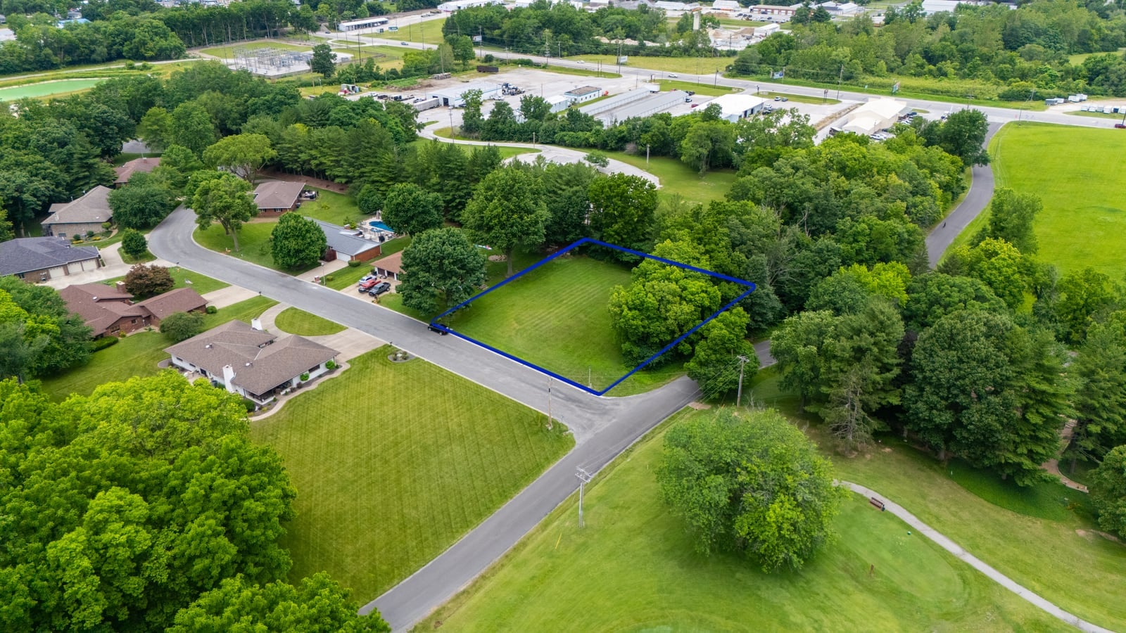
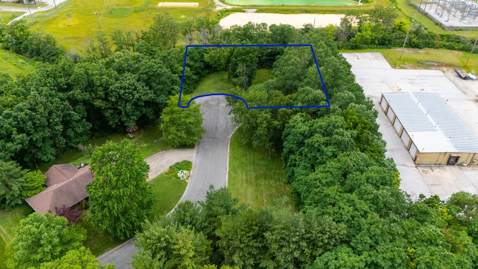
For this project, Spradlin needed to market three empty lots: a mix of residential and commercial development ground. The challenge: each lot was tucked among trees, roads and neighboring buildings, so a ground-level photo would have left buyers guessing where one parcel ended and the next began. Our job was to make each lot crystal clear from the air, then mark the exact boundaries so online bidders knew precisely what was up for sale.
Custom Property-Line Overlays: Show Buyers Exactly What They’re Bidding On
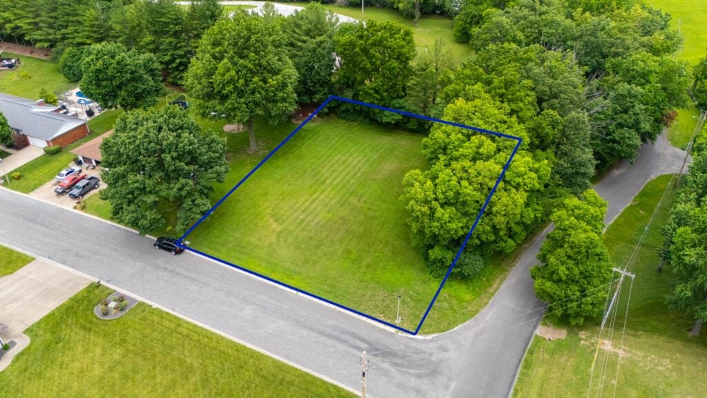
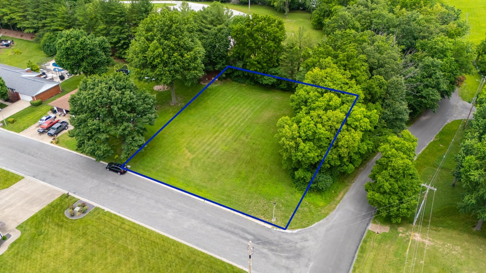
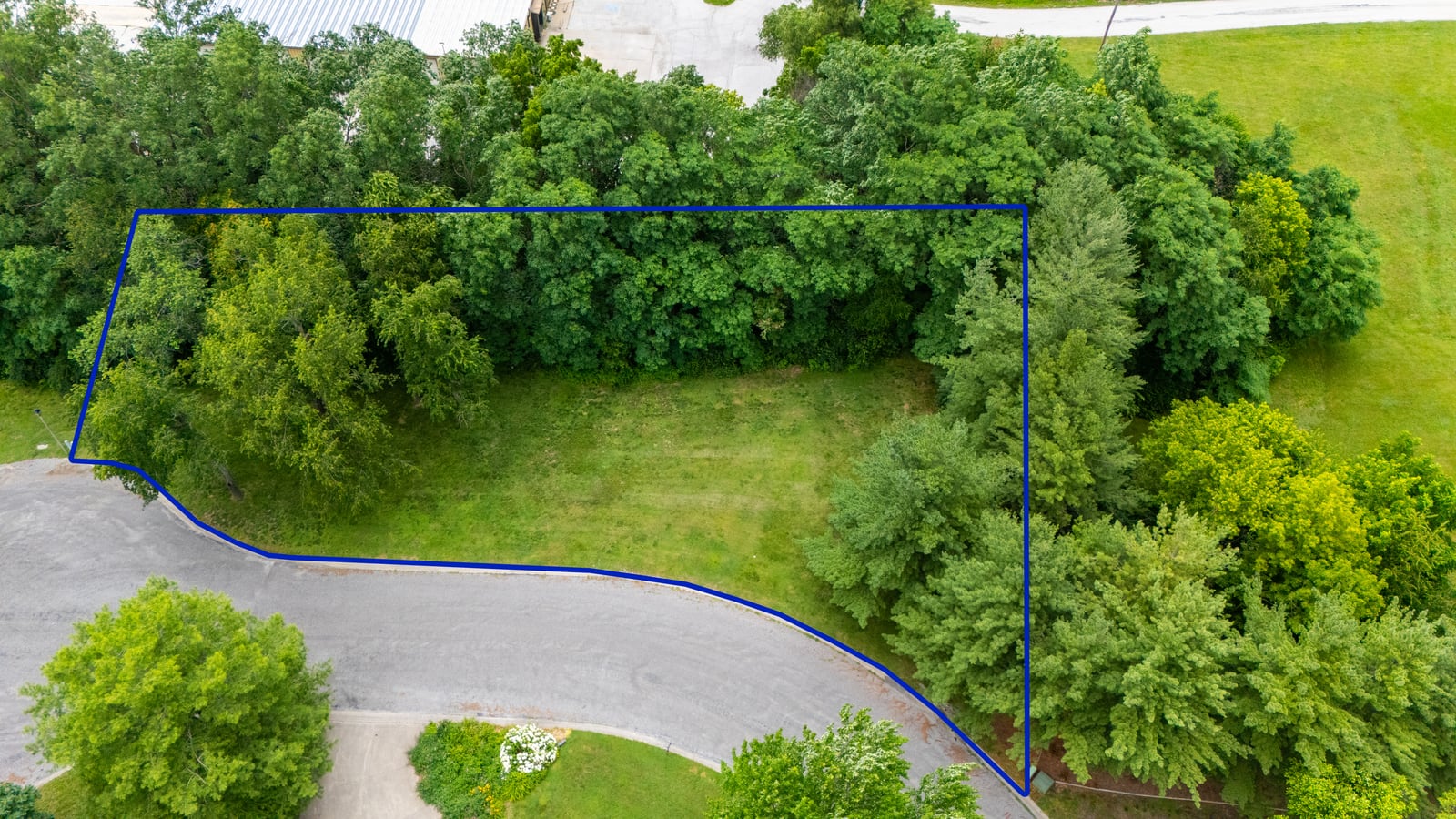
This is where aerial photography for land really earns its keep. After capturing each lot, we added a clean blue property-line overlay tracing the exact parcel boundary onto the drone image. Instead of a vague “the lot is somewhere in here,” a buyer sees the precise footprint: the road frontage, the buildable area, where the tree line falls inside or outside the line, and how the parcel sits relative to its neighbors.
For auctions especially, this clarity is gold. It reduces buyer hesitation, cuts down on “where exactly is it?” phone calls, and builds the kind of confidence that turns a casual browser into a registered bidder. It’s the difference between a listing that gets scrolled past and one that gets bid up.
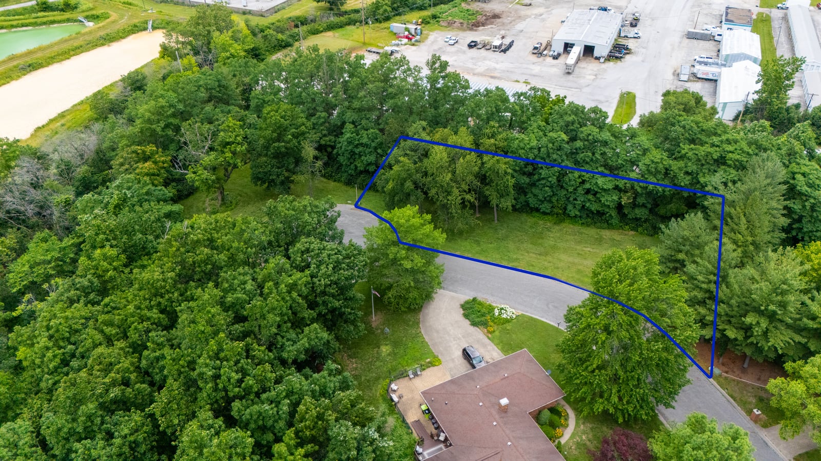
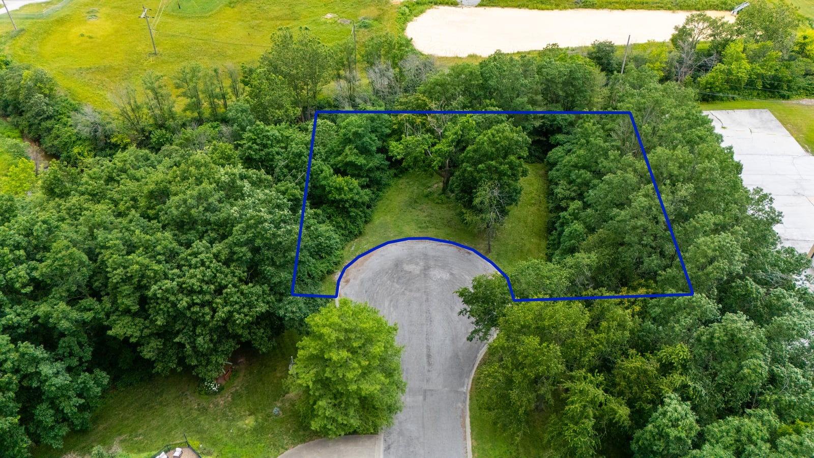
On land and lot auctions, a property-line overlay does in one image what a paragraph of description never could. It shows the buyer exactly what they’re bidding on.
The Selective-Color Highlight Technique
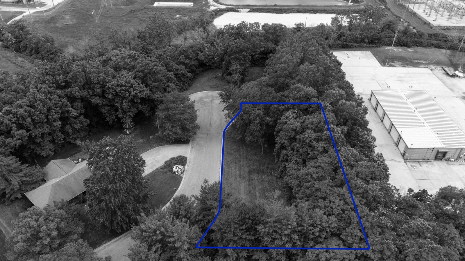
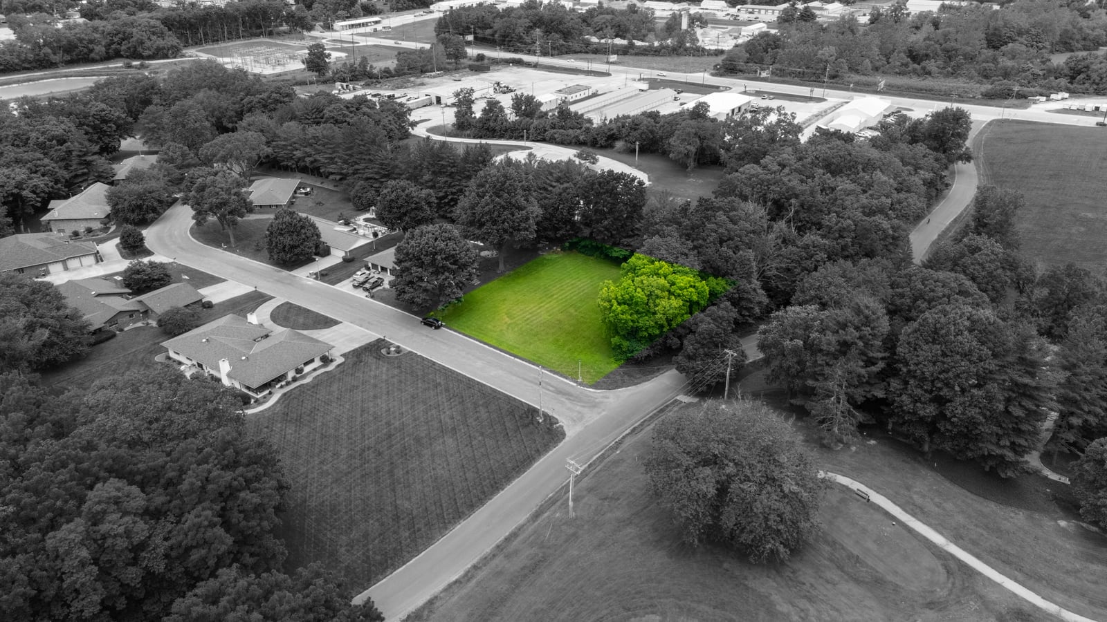
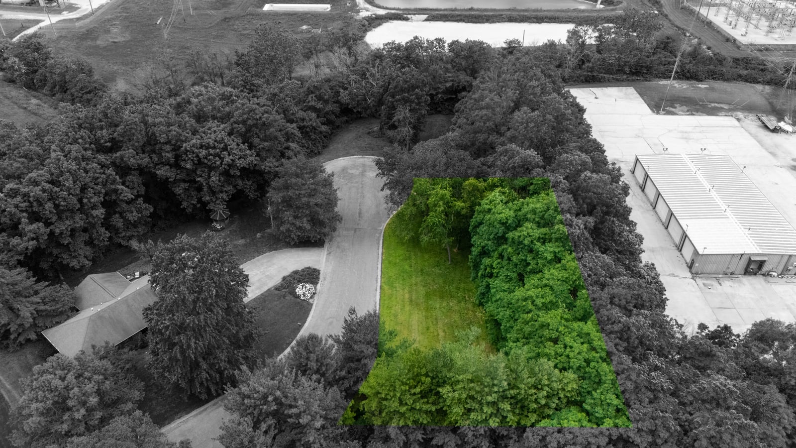
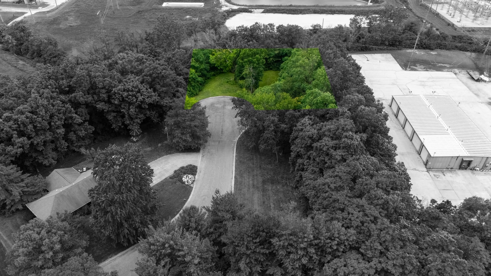
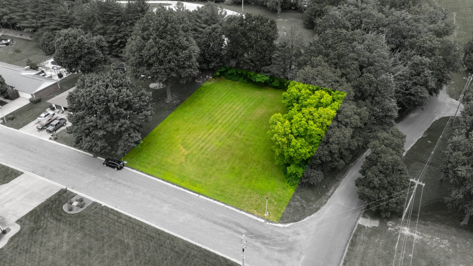
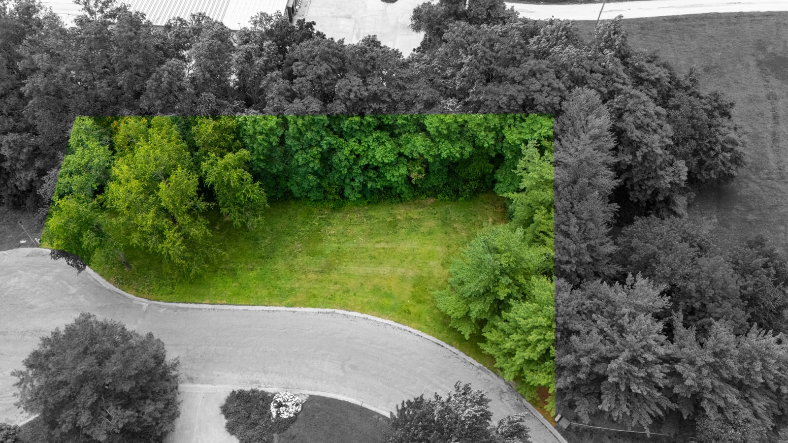
For a second set of images, we used a selective-color technique: the surrounding neighborhood is rendered in black and white while the for-sale lot stays in full, vivid color. The effect is impossible to ignore. The buyer’s eye goes straight to the parcel, and the property pops off the screen in a crowded listing feed or auction catalog.
It’s a small creative touch with a big marketing payoff. In a grid of thumbnails on an online auction platform, an image where the subject literally glows in color earns the click. Pair that with the boundary-overlay version and a seller has two distinct, scroll-stopping ways to present the same lot.
What Aerial Photography Captures That Ground Photos Can’t
Whether you’re a realtor, auctioneer, developer or commercial broker, here’s what professional real estate drone photography delivers that a phone or DSLR on the ground never will:
- True scale & shape: the full footprint of a lot or building in one frame.
- Boundaries & frontage: especially with property-line overlays added in post.
- Location context: roads, access, neighbors, and proximity to commercial or residential use.
- Topography & features: tree cover, drainage, ponds, clearings and usable acreage.
- Curb appeal from above: sweeping, magazine-quality shots that elevate the whole listing.
- Marketing assets: stills and 4K video for social media, MLS, auction sites and email.
That last point matters more every year. Commercial real estate drone photography and aerial video now feed everything from MLS listings and auction catalogs to Facebook ads, Instagram reels and email blasts. One drone flight produces a library of assets a seller can use across every channel, which is a big reason aerial photography has gone from luxury add-on to standard practice on serious listings.
Who Uses Drone Photography for Real Estate?
This kind of aerial work isn’t just for high-end home sales. Across Central Illinois, we capture properties for a wide range of clients:
- Auctioneers marketing land, lots, farms and estates to live and online bidders.
- Residential realtors showcasing homes, acreage and neighborhood context.
- Commercial brokers presenting retail, industrial and development parcels.
- Land developers documenting sites before, during and after development.
- Builders & contractors tracking progress and creating portfolio content.
- Business owners who want striking aerial photos of their property and operations.
If you’re selling anything where the land itself is the story (vacant lots, farmland, commercial ground, or sprawling estates), aerial photography isn’t optional. It’s the single best way to help a buyer understand and fall in love with the property before they ever visit.
Licensed, Insured & FAA Part 107 Certified
One thing every seller should ask before hiring a drone photographer: are they actually licensed to do this commercially? Flying a drone for any business purpose, including real estate listings and auctions, legally requires an FAA Part 107 Remote Pilot Certificate. Elevated Ideas is fully licensed and insured, and we hold an FAA Certificate of Waiver for advanced operations, so your project is handled safely, legally and professionally from takeoff to final delivery.
It also means faster, cleaner results. We know how to plan a flight around lighting, weather and airspace, capture the right angles the first time, and turn around polished, edited images (boundary overlays and all) on a timeline that keeps your listing or auction on schedule.
More Than Photos: 4K Aerial Video for Listings
Still images do the heavy lifting on a listing page, but aerial video is what stops the scroll on social media. A smooth, cinematic flight over a property (rising up to reveal the full parcel, then gliding across the boundary line) gives buyers a sense of place that no photo can match. For auctioneers and brokers, that footage becomes the centerpiece of a Facebook or Instagram promotion, an email teaser, or a YouTube walkthrough that keeps a property top-of-mind right up to auction day.
Every drone shoot we do can deliver both: a full set of high-resolution stills for the MLS and auction catalog, plus edited 4K aerial video built for the feeds where buyers actually spend their time. One flight, a complete marketing kit: photos, video, and add-ons like the property-line overlays and selective-color highlights you see throughout this post.
Aerial Photography That Pays for Itself
It’s fair to ask whether drone photography is worth the cost, especially on a modest lot or a fast-moving auction. In our experience, it pays for itself many times over. A property that’s easy to understand attracts more registered bidders and more competitive offers, and a listing that looks professional reflects directly on the seller and the auction house behind it. On land and lot sales, where buyers can’t walk every inch before they bid, that clarity and confidence can be the difference between a single bid and a bidding war.
There’s also a compounding benefit: the images don’t expire when the sale closes. Auctioneers and brokers reuse strong aerial photos and video in portfolios, case studies, “sold” posts and future pitches: proof to the next seller that their property will be marketed the right way. For the price of one shoot, you walk away with a marketing asset that keeps working long after the gavel falls. That’s exactly the kind of value real estate drone photography delivered for Spradlin Auction’s lots, and it’s what we deliver for sellers across Central Illinois.
Selling Land, Lots or Commercial Property? Let’s Get You in the Air.
From auction listings and vacant lots to commercial buildings and acreage, Elevated Ideas captures stunning 4K aerial photos and video, with custom property-line overlays available. Serving Jacksonville and all of Central Illinois.
Licensed FAA Part 107 pilots • 4K aerial photo & video • Fast turnaround across Central Illinois
Good To Know
Real Estate Drone Photography FAQs
How much does real estate drone photography cost?
Pricing depends on the size of the property, how many lots or buildings are involved, and whether you need extras like property-line overlays, 4K video or rush delivery. Most single-property real estate drone photography packages are quoted as one flat rate per property. Contact Elevated Ideas for a quick custom quote for your listing or auction.
Can you add property lines to drone photos?
Yes. We add clean, custom property-line overlays directly onto the aerial image so buyers can see the exact parcel boundary, road frontage and buildable area. It is one of the most popular add-ons for land and lot auctions because it removes guesswork and builds bidder confidence.
Do you do commercial real estate drone photography?
Absolutely. We capture commercial parcels, industrial sites, development land, retail buildings and vacant lots for brokers, auctioneers and developers throughout Central Illinois, both still photos and 4K aerial video.
Is a license required to fly a drone for real estate listings?
Yes. Any drone work for a business purpose, including real estate and auction marketing, requires an FAA Part 107 Remote Pilot Certificate. Elevated Ideas is fully licensed and insured and holds an FAA Certificate of Waiver for advanced operations.
How fast can you deliver the photos?
In most cases we can fly within a few days of booking and deliver edited images shortly after, fast enough to keep your listing or auction on schedule. Need it sooner? Just ask about rush turnaround.
What areas do you serve?
Elevated Ideas is based in Central Illinois and provides drone photography and video for Jacksonville, Morgan County and the surrounding region. Visit our drone photography and video page to get started.