
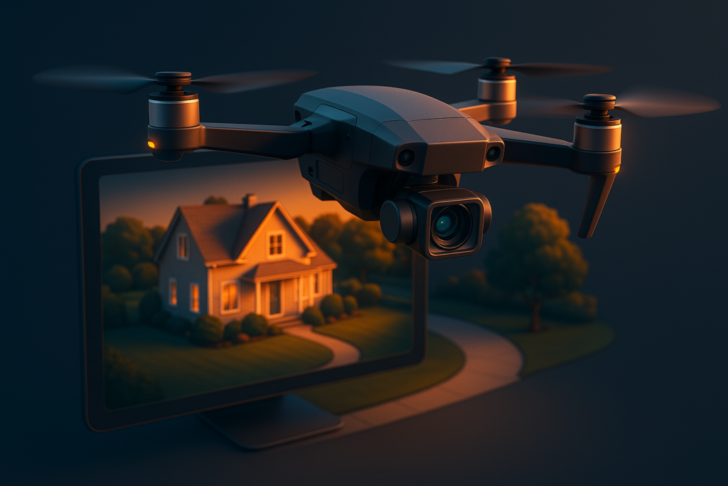
Real estate listings with aerial photography receive 68% more views and sell up to 32% faster than those relying on ground-level photos alone. In the Midwest real estate market — where properties frequently sit on large lots with acreage, lakefront access, scenic landscapes, and rural charm that ground photos simply cannot capture — professional drone photography has moved from luxury differentiator to competitive necessity. Agents who include aerial imagery in every listing consistently win more listing appointments, generate more buyer interest, and close deals faster than those still relying on smartphone photos shot from the front yard.
Why Aerial Photography Sells Properties Faster
The case for drone photography in real estate is no longer theoretical — it is backed by hard data from MLS studies, NAR research, and real-world market performance across thousands of listings. In an era where 97% of home buyers start their search online, the first showing happens on a screen, not in person. Properties have roughly 3-5 seconds to capture a buyer’s attention while scrolling through listing feeds, and aerial imagery stops the scroll in a way that standard front-of-house photos cannot.
The impact is particularly pronounced for properties above the median price point, where buyers expect a premium marketing presentation. But even for mid-range homes, aerial photography creates a perception of higher value and more professional marketing — which reflects directly on the listing agent’s reputation. Sellers notice which agents invest in premium marketing, and that investment translates to more listing appointments for agents who consistently use aerial imagery.
Beyond the listing itself, drone content performs exceptionally well on social media. Real estate drone videos are among the most shared content types on Instagram, Facebook, and TikTok, giving your listing organic reach far beyond the MLS. A single well-produced drone video can generate thousands of views and dozens of inquiries from buyers who would never have seen a standard listing photo.
- 68% more listing views — Properties with aerial photography receive 68% more clicks and views on MLS platforms, Zillow, Realtor.com, and agent websites compared to listings with only ground-level photos. More views mean more showings, and more showings mean faster sales.
- 32% faster time to sale — Listings featuring drone photography and video sell 32% faster on average, reducing days on market from a median of 45 to approximately 31. Every week a property sits unsold costs the seller in mortgage payments, maintenance, and opportunity cost.
- Homes priced above $200K see the biggest impact — While all price ranges benefit from aerial imagery, properties above $200K see disproportionately higher engagement because buyers at this level expect comprehensive visual marketing and are more likely to skip listings that appear under-marketed.
- 83% of home sellers prefer agents who use drone photography — According to NAR data, the vast majority of sellers consider drone photography an important factor when selecting a listing agent. Offering aerial imagery as a standard part of your marketing package is a powerful listing presentation differentiator.
- 3x more social media engagement — Drone photos and videos generate 3x more likes, shares, comments, and saves on social media compared to standard real estate photos. This organic amplification extends your listing’s reach far beyond paid advertising.
- Higher perceived property value — Professional aerial photography creates a “wow factor” that makes properties appear more valuable, more spacious, and more desirable. Multiple studies show that buyers estimate 3-5% higher value for properties with comprehensive aerial marketing packages.
- Agent differentiation in competitive markets — In markets where hundreds of agents compete for listings, offering professional drone photography as a standard service creates instant differentiation. Sellers remember the agent who showed up with a drone more than the one who showed up with a smartphone.
“In a market where the first showing happens on a phone screen, aerial photography is not an upgrade — it is table stakes. The agents who understand this are winning the best listings.”
Essential Drone Shots Every Listing Needs
A professional real estate drone shoot is not just “fly up and take a picture.” It is a strategic sequence of shots designed to tell the property’s story from angles that ground photography physically cannot achieve. Each shot serves a specific purpose in the buyer’s decision journey — from establishing location context to revealing property boundaries to creating an emotional connection with the outdoor spaces. A complete aerial shot list for a residential listing typically includes 7-10 key compositions.
The order in which these shots appear in the listing also matters. Lead with the most dramatic aerial shot (usually the establishing wide-angle view) to stop the scroll, follow with property-specific detail shots that answer buyer questions (lot size, backyard layout, neighborhood), and close with the most emotionally compelling shot (golden hour, sunset, or a cinematic video clip). This sequence mirrors the buyer’s thought process: interest, evaluation, desire.
- Establishing shot (wide aerial) — A high-altitude view showing the property in its full context: the lot, the surrounding neighborhood, proximity to roads, parks, schools, shopping, and natural features. This shot answers the buyer’s first question: “Where is this property and what is around it?”
- Property boundary shot — A directly overhead (nadir) or high-angle shot that clearly shows the lot lines, fencing, driveway, outbuildings, and the full extent of the property. For acreage properties, this shot is essential because ground photos cannot convey the scale of 2, 5, or 20 acres.
- Backyard reveal — A slow descending shot from aerial altitude into the backyard showing the pool, patio, deck, landscaping, fire pit, or outdoor kitchen from above before transitioning to eye level. This is the most engaging shot type for properties with strong outdoor living spaces.
- Street approach (buyer perspective) — A low-altitude forward-tracking shot approaching the front door from the street, simulating the buyer’s first in-person impression. This cinematic technique creates an emotional “welcome home” feeling that static photos cannot achieve.
- 360-degree orbit — A smooth, slow circle around the entire property showing every exterior angle in a single continuous shot. This gives buyers a comprehensive view of the home’s architecture, condition, and surroundings that would require dozens of individual ground photos to replicate.
- Neighborhood context pull-back — Starting tight on the property and slowly pulling back to reveal the neighborhood, nearby amenities, walking trails, water features, schools, and parks. This contextualization shot is especially valuable in desirable neighborhoods where location is a major selling point.
- Golden hour and sunset shots — Aerial photography during the golden hour (the last hour before sunset) produces warm, magazine-quality lighting that makes every property look its absolute best. Golden hour drone shots consistently generate the highest engagement on MLS and social media platforms.
Why Midwest Properties Benefit Most from Aerial Imagery
Midwest real estate has unique characteristics that make drone photography not just valuable but essential for effective property marketing. Unlike dense urban markets where homes sit on quarter-acre lots in cookie-cutter subdivisions, Midwest properties frequently feature large lots, acreage, waterfront access, agricultural components, and rural settings that simply cannot be conveyed through ground-level photography. A ground photo of a 10-acre property with a pond, two outbuildings, and 200 feet of creek frontage looks the same as a photo of a half-acre suburban lot — until you see it from the air.
The Central Illinois and Lake of the Ozarks markets, in particular, benefit enormously from aerial photography because of the diversity of property types. From lakefront homes with private docks to farmstead properties with multiple outbuildings to new construction developments where progress documentation is needed, drone photography addresses marketing challenges that are unique to the region. And because many competing agents in these markets still rely on ground-level smartphone photos, the competitive advantage of professional aerial imagery is outsized.
For agents working in markets like Springfield, Morgan County, and surrounding Central Illinois communities, offering professional drone photography as a standard listing service creates immediate differentiation from the hundreds of agents who are still uploading 15 smartphone photos and calling it a day.
- Acreage and large lots — Ground photos cannot show 5, 10, or 50 acres. Aerial views reveal the full property boundary, terrain features, tree coverage, fencing, and usable land in a single compelling image. For acreage properties, this is not a nice-to-have — it is the only way to accurately represent what the buyer is purchasing.
- Lakefront and waterfront properties — Drone shots from over the water looking back at the property are the single most compelling images in waterfront real estate marketing. These shots show the dock, shoreline, water depth, proximity to the lake, and the view the buyer will enjoy every day — perspectives impossible from the ground.
- Farm and rural properties — Outbuildings, fields, ponds, timber stands, access roads, and fencing are best shown aerially. Buyers considering farm properties need to see the full layout and condition of all structures and land features, which requires an overhead perspective.
- New construction and development sites — Builders use drone photography for construction progress documentation, marketing of new developments, and showcasing lot availability within subdivisions. Monthly aerial updates create a compelling visual timeline that generates buyer interest during the build process.
- Neighborhood and community context — Springfield, Jacksonville, and Central Illinois neighborhoods often feature tree-lined streets, proximity to parks and walking trails, and community amenities that aerial shots showcase beautifully. These context shots sell the lifestyle, not just the property.
- Lake of the Ozarks vacation and rental properties — Vacation and short-term rental properties at the Lake of the Ozarks benefit enormously from aerial photography showing lake access, cove locations, dock configurations, and proximity to entertainment districts. These shots drive bookings and buyer interest from out-of-state buyers who cannot visit in person before making a decision.
“In the Midwest, where properties are defined by their land as much as their structures, aerial photography is not optional marketing — it is the only way to honestly represent what you are selling.”
Beyond Still Photos: Drone Video That Sells
While aerial still photos are the baseline, drone video takes real estate marketing to an entirely different level. Video content generates 403% more inquiries than listings without video, and drone video specifically creates the immersive, cinematic experience that makes buyers feel emotionally connected to a property before they ever set foot on it. In a market where buyers are often relocating from other states and making purchasing decisions based heavily on online content, drone video is the closest thing to an in-person showing.
The types of drone video used in real estate marketing range from simple flyover clips for social media to full cinematic property tours set to music. The right approach depends on the property, the target buyer, and the marketing platform. A luxury lakefront home warrants a 90-second cinematic production, while a standard suburban listing might need a 15-second Instagram Reel that shows the neighborhood and backyard from above. The key is matching the video production to the property’s value and the buyer’s expectations.
- Cinematic property tours (60-90 seconds) — Full aerial video tours set to music that walk buyers through the property from the sky, transitioning from wide establishing shots to intimate property details. These videos are the centerpiece of luxury listing marketing and generate massive social media engagement.
- FPV (First Person View) footage — Immersive racing-drone footage that flies through and around properties at high speed for a dynamic, adrenaline-fueled viewing experience. FPV content goes viral on social media regularly and is especially effective for unique properties, large estates, and commercial spaces.
- Virtual tour integration — Combining aerial drone footage with interior Matterport or 3D tour walkthroughs creates a seamless experience that takes the buyer from sky to front door to every room. This complete virtual showing is essential for out-of-state buyers and relocation clients.
- Social media clips (15-30 seconds) — Vertical-format video snippets optimized specifically for Instagram Reels, TikTok, YouTube Shorts, and Facebook Stories. These short-form clips generate massive organic reach and drive traffic to the full listing. A single 15-second drone clip can reach 10,000+ viewers organically.
- MLS-formatted video — Properly formatted and compressed video files that meet MLS upload requirements (typically MP4, under 100MB, 16:9 aspect ratio). Many agents skip MLS video upload because of technical requirements — professional drone operators handle this formatting as part of the delivery package.
- Construction progress documentation — Monthly aerial video flyovers of construction projects create compelling visual timelines for builders, developers, and buyers watching their future home take shape. This content also serves as valuable project documentation for contractors and lenders.
FAA Compliance and What to Verify Before Hiring
Not all drone photographers are operating legally, and hiring an uncertified operator puts you, your brokerage, and your seller at legal and financial risk. The FAA requires Part 107 Remote Pilot certification for all commercial drone operations in the United States, and violations can result in civil penalties up to $37,377 per occurrence. Beyond the legal risk, uncertified operators typically lack the insurance, equipment quality, and flight planning expertise that professional real estate drone photography demands.
As a real estate agent or seller, you share liability if the drone operator you hire causes property damage, injures someone, or violates airspace regulations during a shoot on your listing. Protect yourself by verifying credentials before every engagement — not just trusting that the person who shows up with a drone knows what they are doing. A surprising number of “drone photographers” on social media are operating without FAA certification or insurance.
Elevated Ideas is FAA Part 107 certified and fully insured for commercial drone operations across Central Illinois and the Lake of the Ozarks region. Every flight is planned with airspace authorization, weather assessment, and safety protocols in place before the drone ever leaves the ground.
- FAA Part 107 Remote Pilot Certificate — This is non-negotiable for commercial drone operations. Ask to see the physical certificate or verify the operator’s certificate number through the FAA’s online database. If they cannot produce Part 107 certification, do not hire them regardless of how good their portfolio looks.
- Liability insurance ($1M minimum coverage) — Professional drone operators carry liability insurance that covers property damage, personal injury, and equipment damage during flights. $1 million is the industry standard minimum. Some commercial properties and HOAs require proof of insurance before allowing drone flights.
- Airspace authorization for controlled zones — Properties near airports, military installations, or in special-use airspace require LAANC (Low Altitude Authorization and Notification Capability) authorization before flight. Professional operators handle this authorization automatically — amateur operators often do not even know it is required.
- Professional-grade equipment — Look for operators using DJI Mavic 3 Pro, DJI Air 3, or DJI Inspire 3-caliber equipment with Hasselblad or equivalent camera systems. Consumer-grade drones (DJI Mini, older Phantom models) produce noticeably lower image quality for professional real estate marketing.
- Real estate-specific portfolio — Review their completed real estate drone work specifically, not just general drone photography. Shooting real estate from the air requires different compositions, altitudes, and techniques than landscape photography, event coverage, or construction documentation.
- Weather monitoring and rescheduling policy — Professional operators monitor weather forecasts and make go/no-go decisions based on wind speed, precipitation, cloud cover, and lighting conditions. They should offer free rescheduling for weather cancellations without pressuring you to shoot in marginal conditions.
- Delivery timeline and format specifications — Professional operators deliver edited photos within 24-48 hours and video within 3-5 business days. Files should be delivered in both web-optimized formats (for MLS and social media) and full-resolution formats (for print marketing and large displays).
Maximizing Your Aerial Content Across Marketing Channels
Getting professional drone photos and video is only half the equation. The other half is strategically deploying that content across every marketing channel to maximize its impact. Too many agents pay for drone photography and then upload the images to MLS and call it done. That is like buying a billboard and only showing it to your neighbors. Your aerial content should be working for you across MLS, social media, email marketing, your website, print materials, and paid advertising simultaneously.
Each marketing channel has different optimal formats, aspect ratios, and content lengths. The same drone footage can be cut into a 60-second YouTube video, a 15-second Instagram Reel, a thumbnail for email campaigns, a hero image for your listing page, and a print-ready image for direct mail postcards. When you plan your drone shoot with multi-channel distribution in mind, you extract 5-10x more value from a single shoot than agents who only think about MLS photos.
- MLS listing optimization — Lead with your best aerial photo as the primary listing image. Properties with aerial primary photos receive 68% more clicks in search results. Include 3-5 aerial images in the photo gallery interspersed with interior shots. Upload your property video directly to the MLS video field.
- Social media distribution — Post drone photos to Instagram (carousel format), Facebook (single image and video), TikTok (vertical video), and YouTube (full property tour). Schedule posts across multiple days to maximize reach. Tag the property location and use relevant hashtags for your market area.
- Email campaign integration — Use the best aerial shot as the hero image in your “Just Listed” email campaign. Embed the property video directly in the email for maximum engagement. Drone imagery in email campaigns increases click-through rates by 42% compared to standard property photos.
- Website listing pages — Feature drone content prominently on your website’s property listing pages. Use aerial photos as full-width hero images and embed the property video above the fold. Include a downloadable aerial photo gallery for serious buyers who want to study the property in detail.
- Paid advertising creative — Use drone footage in your Google Ads display campaigns and Facebook/Instagram ad creative. Aerial video ads consistently outperform static image ads for real estate, with 2-3x higher click-through rates and lower cost per lead.
- Print marketing materials — Include aerial photos in listing brochures, postcards, door hangers, and open house flyers. A stunning aerial shot on a direct mail postcard generates significantly higher response rates than standard curb-appeal photos.
“A professional drone shoot gives you content for 10+ marketing channels. The agents who maximize that content across every channel see 5-10x the return on their investment in aerial photography.”
Real Estate Drone Photography Pricing and Packages
Understanding drone photography pricing helps you budget appropriately and evaluate proposals from different operators. Pricing varies based on property size, location, deliverables, and the operator’s experience and equipment. However, for most residential real estate listings, drone photography is one of the highest-ROI marketing investments an agent can make — a $200-$400 investment on a $300,000 listing that sells 32% faster easily pays for itself many times over.
When comparing quotes from different drone operators, focus on the deliverables and turnaround time rather than just the bottom-line price. A $150 shoot that delivers 10 unedited aerial photos in a week is worth less than a $350 shoot that delivers 20 edited photos, a 60-second property video, social media clips, and MLS-formatted files within 48 hours. The cheapest option is rarely the best value in real estate marketing.
- Basic aerial photo package ($150-$250) — 10-15 edited aerial still photos, delivered within 48 hours. Suitable for standard residential listings under $300K where the primary goal is supplementing ground-level MLS photos with aerial context shots.
- Photo + video package ($250-$400) — 15-25 edited aerial photos plus a 60-90 second property video with music and titles. This is the sweet spot for most residential listings and provides content for MLS, social media, and email marketing.
- Premium production package ($400-$750) — Full aerial photo gallery, cinematic property video, social media clips (vertical format), twilight/golden hour shots, and MLS-formatted deliverables. Recommended for luxury listings, lakefront properties, and acreage properties where premium marketing matches premium pricing.
- Agent subscription packages — High-volume agents benefit from monthly subscription pricing that covers a set number of shoots per month at a discounted per-shoot rate. Elevated Ideas offers brokerage and agent subscription packages for consistent, predictable drone photography costs.
- Commercial and large property pricing ($500-$1,500+) — Commercial real estate, large acreage, multi-building properties, and development sites require more flight time, additional equipment, and extended post-production. Pricing is typically quoted per project based on scope.
- Rush delivery surcharge — Same-day or next-day editing delivery typically adds 25-50% to the base price. Planning shoots 48-72 hours before you need the content avoids rush fees and ensures the best weather window.
Ready to Elevate Your Listings?
Professional drone photography that sells properties faster. FAA Part 107 certified, fully insured, serving Central Illinois and Lake of the Ozarks. Book your first shoot and see the difference aerial imagery makes.
No phone call needed for the marketing report. Delivered straight to your inbox.
COMMON QUESTIONS
Drone Real Estate FAQ
How much does drone photography cost for a real estate listing?
Real estate drone photography packages typically range from $150-$500 per property depending on property size, number of deliverables (photos only vs. photos + video), and whether you need standard or premium production. Elevated Ideas offers competitive packages for individual agents, brokerages, and high-volume subscription pricing.
How long does a real estate drone shoot take on-site?
Most residential drone shoots take 30-60 minutes on-site. Larger properties (5+ acres), commercial listings, or comprehensive video packages may require 1-2 hours. Edited photos are typically delivered within 24-48 hours, and video within 3-5 business days. Rush delivery is available for time-sensitive listings.
Can drones fly near airports or in controlled airspace?
Yes, with proper authorization. FAA LAANC (Low Altitude Authorization and Notification Capability) allows certified operators to fly in controlled airspace near airports at approved altitudes. Elevated Ideas handles all airspace authorizations automatically for every shoot, including properties near Springfield’s Abraham Lincoln Capital Airport and other controlled zones.
What weather conditions prevent drone photography?
Rain, snow, sustained winds above 25 mph, thunderstorms, and dense fog prevent safe drone operations. Light overcast skies actually produce excellent real estate photos with soft, even lighting and no harsh shadows. We monitor weather forecasts 48 hours in advance and proactively reschedule shoots at no charge if conditions are unsafe or will produce poor results.
Do I own the drone photos and video after the shoot?
Yes. Elevated Ideas provides full commercial usage rights for all delivered photos and video. Use them on MLS, your website, social media, print materials, email campaigns, paid advertising, and anywhere else you market the listing with no additional licensing fees or usage restrictions.
Can drone photography be used for commercial properties and construction sites?
Absolutely. Commercial real estate, construction progress documentation, agricultural operations, hospitality properties, event venues, and industrial facilities all benefit significantly from aerial photography and video. Commercial projects are priced individually based on scope, location, and deliverable requirements. Contact us for a custom commercial project quote.
How far in advance should I schedule a drone shoot?
Book 3-5 business days in advance for standard scheduling, or 48 hours for rush requests (subject to availability and weather). During peak real estate season (April through September), earlier booking is recommended as schedules fill quickly. Elevated Ideas offers priority scheduling for agents on subscription packages.
What areas does Elevated Ideas serve for drone photography?
Elevated Ideas provides drone photography and video services across Central Illinois (Springfield, Jacksonville, Decatur, Champaign, Bloomington-Normal, Quincy, and surrounding communities) and the Lake of the Ozarks region in Missouri. Travel fees may apply for locations beyond our standard service area.
Written by Ryan Mason, Founder of Elevated Ideas — helping businesses grow with WordPress web design, CRM automation, drone photography, and AI-powered marketing. Last updated 2026.