
Working with a local team helps: Explore our Lake of the Ozarks digital marketing services.
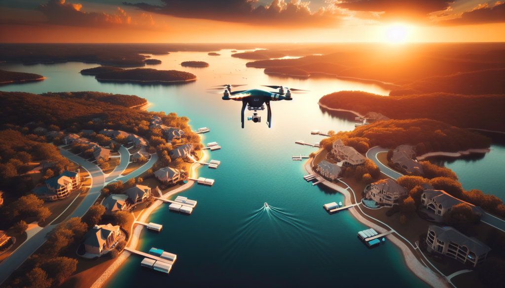
Lake of the Ozarks is one of Missouri’s most photographed destinations — but most of those photos are taken from shore. From the ground, you see a dock, a stretch of shoreline, maybe a slice of blue water between the trees. From 400 feet in the air, you see something entirely different: the full serpentine curve of 1,150 miles of shoreline, coves that glow turquoise at sunrise, lakefront homes nestled into bluffs with private docks stretching into water so calm it mirrors the sky. That perspective changes everything — especially when you’re trying to sell a property, market a resort, or attract visitors to the lake.
Drone photography at Lake of the Ozarks has become one of the most effective marketing tools for real estate agents, resort owners, marina operators, and tourism businesses across Camden County and the greater LOTO region. Listings with aerial photos sell 68% faster than those with ground-level shots alone. Social media posts featuring drone content generate up to 10 times more engagement than standard photography. And in a market where waterfront properties routinely sell for $500,000 to several million dollars, the ROI on a single drone session can be measured in thousands.
Whether you’re a real estate agent listing a lakefront estate on the Osage Beach side, a resort owner at the 30 mile marker trying to fill cabins during shoulder season, or an event organizer promoting a boat show at Dog Days, this guide covers exactly how aerial photos Lake Ozark MO professionals produce can transform your marketing — and why the lake is one of the most spectacular places in the Midwest to fly.
Why Lake of the Ozarks Is a Drone Photographer’s Dream
Not every location is equally suited for aerial photography. Lake of the Ozarks happens to be one of the best. The lake’s unique dragon-shaped geography — created when Bagnell Dam impounded the Osage River in 1931 — produces a landscape that is genuinely stunning from above. Deep coves branch off the main channel like fingers, creating patterns that are invisible from the ground but breathtaking at altitude.
The combination of clear water, dramatic bluffs, dense tree coverage, and dense waterfront development creates natural contrast that photographs beautifully. At golden hour, the entire lake surface transforms into a sheet of liquid amber. During fall, the surrounding Ozark forests explode in color that extends to the waterline. Even in winter, the bare hardwoods and low-angle light create a stark, moody atmosphere that real estate photographers prize.
“From the ground, a lakefront property is a house with a dock. From the air, it’s a lifestyle — private cove, deep water, covered boat slip, and nothing but lake in every direction. That’s what sells.”
The sheer density of marketable properties and businesses along the shoreline makes LOTO a drone photography hub. Within a 30-minute flight window, a pilot can capture a lakefront listing, swing over to a marina for promotional footage, and finish with a sunset flyover of the Party Cove area. No other lake in Missouri — and few in the entire Midwest — offer that concentration of opportunity.
Types of Drone Shots for Lakefront Properties
Professional drone photography at the lake isn’t just about flying up and pointing the camera down. Different shot types serve different marketing purposes, and the best drone pilots plan their flight paths like a cinematographer plans a film sequence.
Flyover Shots
The classic flyover starts behind a property and moves forward over the rooftop, revealing the dock, the water, and the surrounding cove in one smooth motion. This is the single most effective shot for real estate listings because it shows the property’s relationship to the water in a way that ground photos never can. Buyers instantly understand the lot size, dock configuration, water depth (visible from above), and proximity to the main channel.
Reveal Shots
A reveal shot starts low and rises dramatically, or begins facing away from the subject and rotates to unveil it. For lakefront homes, the most powerful version starts at water level near the dock and ascends to 200 feet, gradually revealing the full property, the cove, and the surrounding landscape. This creates an emotional “wow” moment that stops the scroll on social media and holds attention on listing pages.
Orbit Shots
The orbit (also called a point-of-interest shot) circles a property at a consistent altitude while keeping the camera locked on the subject. This gives viewers a 360-degree perspective of the home and its surroundings. For lakefront properties, orbits are invaluable because they show what’s on every side of the home — the lake view, the driveway approach, neighboring properties, and tree coverage. A single 30-second orbit can replace a dozen still photos.
Sunset and Golden Hour Shots
Lake of the Ozarks faces generally westward along most of its main channel arms, which means sunset light hits the water at precisely the right angle for dramatic aerial photography. The combination of a glassy lake surface, warm golden light, and a property’s dock lights beginning to glow creates images that are virtually impossible to replicate from the ground. These are the hero shots — the ones that end up as the lead image on a listing, the cover photo on a resort’s website, or the viral post on social media.
Cove-to-Cove Panoramic Shots
Lake of the Ozarks’ branching cove structure is one of its defining features, and capturing it requires altitude and careful camera work. A cove-to-cove pan starts at one arm of the lake and slowly rotates to reveal the next, showing the full scope of the lake’s geography. These shots are ideal for resort marketing, community overview videos, and tourism content because they communicate the sheer scale and beauty of the lake in ways that ground-level photography cannot approach.
Real Estate Drone Photography at Lake of the Ozarks
The real estate market at Lake of the Ozarks is fiercely competitive. In any given month, hundreds of lakefront properties compete for buyer attention across platforms like Zillow, Realtor.com, and local MLS listings. The properties that stand out — the ones that get clicks, showings, and offers — almost always feature professional drone photography.
Lakefront Homes and Estates
For lakefront homes, aerial photography answers the questions that buyers care about most but can’t evaluate from ground photos: How much shoreline does the property have? Is the cove protected from main channel waves? How deep is the water at the dock? What’s the lot look like from above — flat and usable, or steep and wooded? Are there neighboring properties visible, or does it feel private? A single aerial image can answer all of these questions instantly.
Properties priced above $500,000 at LOTO have essentially made professional drone photography a standard expectation. Listings without aerial shots look incomplete — and buyers notice. According to MLS data, homes with drone photography receive 403% more inquiries than listings with ground-level photos only.
Docks, Boat Slips, and Water Features
At Lake of the Ozarks, the dock is often as important as the house. A well-built dock with a covered boat slip, swim platform, and PWC ports can add $50,000 to $150,000 to a property’s value. Drone photography captures dock configurations in their entirety — something that’s nearly impossible from shore or from the water. Buyers can see the number of slips, the roof coverage, the distance to deep water, and the overall condition of the dock structure.
For properties with additional water features like seawalls, private beaches, or boat ramps, aerial photography provides the comprehensive visual documentation that justifies premium pricing. When a buyer can see exactly what they’re getting from 200 feet up, the perceived value increases dramatically.
Condominiums and Lake Communities
Condo developments and planned lake communities benefit enormously from drone photography Lake of the Ozarks professionals provide. A single aerial shot of a complex like Lands End or Four Seasons shows the pool, the marina, the lakefront access, and the surrounding cove — giving potential buyers or renters the full picture in one frame. Community managers and HOAs use this content for marketing materials, websites, and seasonal promotions that drive occupancy during peak rental months.
Related reading: More event & aerial coverage — our Morgan County Fair 2025 drone recap.
Ready to Showcase Your Property?
Whether you’re listing a lakefront home, marketing a resort, or promoting an event at Lake of the Ozarks — drone photography delivers the perspective that sells. Let’s talk about what aerial content can do for your business.
FAA Part 107 certified — fully insured — serving Lake of the Ozarks, Camden County, and all of Central Missouri.
Resort and Marina Marketing With Aerial Footage
Resorts, marinas, and hospitality businesses at Lake of the Ozarks compete for attention in an increasingly crowded digital marketplace. Families planning a lake trip are scrolling through dozens of options on their phones, making split-second decisions about where to book. The businesses with the best visual content win.
Drone footage gives resorts a decisive edge. An aerial video that sweeps over a resort’s pool area, down to the marina, and out across the lake tells a story that no ground-level photo gallery can match. It shows the full scope of the property, the proximity to the water, the quality of the amenities, and — critically — the vibe. A resort that looks stunning from the air feels like a destination worth traveling to.
Marina Promotion
Marinas at LOTO — from the massive operations at mile marker 7 near Bagnell Dam to boutique docks in the Grand Glaize arm — use aerial photography to showcase their slip inventory, fuel docks, and service facilities. A drone shot looking down at a full marina on a summer Saturday communicates capacity, popularity, and atmosphere in a single frame. For marinas selling annual slips or seasonal memberships, this kind of visual proof is worth thousands in marketing value.
Restaurants and bars along the waterfront, including the Strip at Lake of the Ozarks, use drone content for social media campaigns that drive foot traffic. An aerial shot of a packed waterfront patio at sunset, boats rafted up nearby, creates the kind of FOMO content that fills tables during peak season and extends business into the shoulder months.
Event Coverage: Boat Shows, Fireworks, and Races
Lake of the Ozarks hosts some of the biggest events in the Midwest boating world, and drone photography has become essential for capturing them. The lake’s geography — with its wide main channel and protected coves — creates natural amphitheaters that are perfectly suited for aerial coverage.
Events That Demand Aerial Coverage
- Lake of the Ozarks Shootout — The largest unsanctioned boat race in the United States, with powerboats hitting speeds over 200 mph on the main channel. Drone footage captures the speed, the spray, and the massive spectator flotilla in ways that shore cameras simply cannot.
- Aquapalooza and Raft-Offs — Mass gatherings of boats in coves create stunning geometric patterns when viewed from above. These aerial shots become the defining images of each event and drive massive social media engagement.
- Fourth of July Fireworks — Multiple fireworks displays launch simultaneously from locations across the lake. A drone positioned at 300 feet can capture fireworks bursting above the water with hundreds of boats illuminated below — an image that’s impossible from any other vantage point. (Note: FAA temporary flight restrictions may apply; always coordinate with local authorities.)
- Poker Runs and Charity Events — The Lake of the Ozarks is home to several major poker runs each season. Drone coverage of the starting line, with dozens of performance boats lined up and idling, creates compelling content for sponsors and event promoters.
- Fishing Tournaments — Bass and crappie tournaments draw hundreds of boats to LOTO annually. Aerial footage of tournament weigh-ins, boat fleets at launch, and anglers working coves adds production value that event organizers use for promotion and sponsorship decks.
Construction Progress Monitoring for Lake Developments
Lake of the Ozarks is in the middle of a development boom. New condominiums, luxury homes, commercial buildings, and infrastructure projects are going up across Camden, Miller, and Morgan counties. Drone photography has become the standard tool for documenting construction progress at the lake, replacing expensive manned helicopter flights and providing far more detailed coverage.
Developers use scheduled drone flights — weekly, biweekly, or monthly — to create time-lapse documentation of their projects from groundbreaking to completion. These aerial records serve multiple purposes:
- Investor updates — Aerial progress photos provide visual proof of milestones for investors and lenders who may not be local to the lake.
- Dispute resolution — Timestamped aerial images create an objective record of site conditions at any point during construction.
- Marketing pre-sales — Developers marketing condos or lots before completion use drone footage to show the site, the view from different elevations, and the surrounding lake environment to prospective buyers.
- Permit and compliance documentation — Aerial surveys help document compliance with setback requirements, shoreline regulations, and environmental protections enforced by local agencies and the Army Corps of Engineers at LOTO.
For contractors working on dock construction, seawall replacement, and shoreline stabilization, drone photography provides before-and-after documentation that demonstrates workmanship quality and helps win future bids.
FAA Considerations for Flying Over Water
Flying a drone at Lake of the Ozarks requires more than just a good camera and a sense of adventure. The FAA regulates all commercial drone operations under Part 107, and flying over water introduces specific considerations that every pilot — and every client hiring a pilot — should understand.
Key FAA Rules for Lake Operations
- Part 107 certification required — Any drone flight for commercial purposes (including real estate photography, resort marketing, or event coverage) requires the pilot to hold a current FAA Part 107 Remote Pilot Certificate. Flying commercially without this certification is illegal and can result in fines up to $32,666 per violation.
- Visual line of sight — The pilot must maintain visual contact with the drone at all times. Over open water, distances can be deceptive, and sun glare off the lake surface can make it difficult to see a small aircraft. Professional pilots plan their flights to maintain clear visibility.
- Altitude limit of 400 feet AGL — The standard 400-foot ceiling applies over water just as it does over land. At LOTO, this altitude provides outstanding coverage for most real estate, resort, and event photography needs.
- No flight over people — Standard Part 107 rules prohibit flying directly over people who are not participating in the operation. At crowded lake events, this requires careful flight planning to capture the scene while maintaining legal separation from crowds on boats and docks.
- Temporary Flight Restrictions (TFRs) — Major events at the lake may trigger TFRs that restrict or prohibit drone operations. Pilots must check NOTAMs (Notices to Air Missions) before every flight and coordinate with local law enforcement when flying near large events.
- Water landings and recovery — Unlike flying over land, a mechanical failure over water means the drone is likely unrecoverable. Professional pilots carry insurance that covers equipment loss and always plan flight paths that minimize time over open water when possible.
“Always hire a pilot who carries their Part 107 card, proof of insurance, and can show you their pre-flight checklist. At Lake of the Ozarks, the consequences of an unlicensed pilot losing a drone over a crowded cove aren’t just financial — they’re a safety issue.”
Best Seasons and Times for Lake Drone Shots
Timing is everything in drone photography Lake of the Ozarks work. The lake looks dramatically different depending on the season, the time of day, and even the water level. Professional drone photographers plan their shoots around these variables to deliver the most impactful images possible.
Seasonal Guide
- Late Spring (May–June) — The lake is full, the trees are bright green, and the water clarity is at its best after spring rains settle. This is peak season for real estate photography because properties look their absolute best. Bonus: the lake is less crowded on weekdays, giving pilots unobstructed shots.
- Summer (July–August) — Maximum activity on the water. Ideal for resort marketing, event coverage, and lifestyle content. The challenge: boat traffic can create choppy water that reduces the mirror-effect reflections prized in aerial shots. Early morning before boats launch is the sweet spot.
- Fall (September–October) — The Ozark foliage puts on one of the best shows in the Midwest, and it’s spectacular from the air. Fall drone photos of lakefront properties surrounded by crimson and gold foliage are some of the highest-performing real estate images at LOTO. The lower sun angle also produces richer, warmer light throughout the day.
- Winter (November–February) — The lake is drawn down approximately 6 feet for maintenance, exposing shoreline and changing the look of docks and coves. However, winter flying offers unique advantages: zero boat traffic, crystal-clear air, dramatic low-angle light, and moody atmospherics. Construction progress monitoring is particularly effective in winter when tree cover is absent.
Best Times of Day
The golden hours — the first 90 minutes after sunrise and the last 90 minutes before sunset — produce the most stunning aerial photos Lake Ozark MO clients can get. During these windows, the sun sits low enough to cast long shadows that add depth and dimension, while the warm color temperature makes everything from water to rooftops glow. Midday sun creates harsh shadows and washes out the water surface, making it the least desirable time for aerial photography (though it works fine for overhead site surveys and construction documentation).
Wind conditions matter too. Early mornings at LOTO typically bring the calmest water, creating a glass-like surface that produces mirror reflections of docks, homes, and trees. These calm-water shots are the most prized in lakefront real estate photography because they make properties look serene and inviting.
How Drone Content Performs on Social Media
If you’re marketing a business at Lake of the Ozarks, you’re competing for attention against every other resort, restaurant, real estate agent, and marina in the region. The businesses that win on social media are the ones with the best visual content — and nothing outperforms drone footage.
The data is overwhelming. Across platforms like Facebook, Instagram, and TikTok, drone content consistently outperforms ground-level photography by a factor of 10x or more in engagement metrics (likes, shares, comments, saves). Here’s why:
Why Drone Content Dominates Social Media
- Pattern interruption — Aerial perspectives are inherently unusual. When someone scrolling through dozens of ground-level lake photos encounters a sweeping aerial view, they stop. That pause is the single most valuable moment in social media marketing.
- Shareability — People share content that makes them say “wow.” Aerial views of the lake, especially at sunset or during peak fall foliage, trigger that reaction consistently. One well-timed drone shot of a cove at golden hour can generate hundreds of shares and reach tens of thousands of people organically.
- Video retention — Drone video holds viewer attention 3–5x longer than static ground-level video. On platforms like Instagram Reels and TikTok, where watch time drives algorithmic distribution, this translates directly into more reach and more followers.
- Platform favoritism — Meta (Facebook/Instagram) and TikTok’s algorithms actively favor high-engagement content. Because drone posts generate more likes, comments, and shares, the platforms show them to more people. It’s a virtuous cycle.
- Cross-platform versatility — A single drone flight produces content for every platform: vertical video for Reels and TikTok, landscape video for YouTube, still frames for Facebook and Google Business Profile posts, and hero images for your website.
Consider the numbers: a real estate agent who posts a ground-level photo of a lakefront listing might get 20–50 likes and a handful of comments. That same listing showcased with a 30-second drone flyover video routinely pulls 500+ likes, 50+ shares, and generates direct messages from interested buyers. That’s not a marginal improvement — it’s a completely different level of marketing effectiveness.
For resorts and marinas, drone content is the backbone of effective seasonal marketing. A spring drone video showing the lake at full pool, docks gleaming, and the surrounding hills in bloom is the kind of content that fills reservation calendars. Post it in March when families are planning summer trips, and it does the selling for you.
If you’re spending money on social media advertising at Lake of the Ozarks, using drone creative in your ads is one of the highest-ROI upgrades you can make. Ad creative featuring aerial footage consistently delivers lower cost-per-click and higher conversion rates than ground-level alternatives. Check out our drone video work at Buena Vista Campgrounds for an example of how aerial content transforms a property’s marketing presence.
Let’s Elevate Your Lake Marketing
From real estate listings to resort promotion to event coverage — professional drone photography at Lake of the Ozarks delivers results that ground-level content simply can’t match. Ready to see what aerial perspective can do for your business?
FAA Part 107 certified — fully insured — serving Lake of the Ozarks, Camden County, and all of Central Missouri.
Frequently Asked Questions
Drone Photography at Lake of the Ozarks
How much does drone photography cost at Lake of the Ozarks?
Professional drone photography at LOTO typically ranges from $200 to $500 for a standard real estate shoot (15–25 edited aerial photos plus a short video). Larger projects like resort marketing packages, event coverage, or construction monitoring are priced based on scope, flight time, and deliverables. The investment pays for itself quickly — listings with drone photos sell 68% faster and for higher prices than those without.
Can you fly a drone anywhere at Lake of the Ozarks?
Not everywhere. While most of the lake is in uncontrolled (Class G) airspace, commercial drone operations require FAA Part 107 certification. Pilots must stay below 400 feet, maintain visual line of sight, avoid flying directly over people, and check for any Temporary Flight Restrictions (TFRs) related to events. Some areas near private property may also require landowner permission for takeoff and landing. Always hire a certified, insured pilot who understands the local regulations.
What’s the best time of year for drone photos at the lake?
Late spring (May–June) and early fall (September–October) are the prime seasons. Spring offers full water levels, bright green foliage, and clear water. Fall delivers spectacular Ozark foliage colors and warm, low-angle light. Summer works well for lifestyle and event content, while winter is ideal for construction documentation and moody atmospheric shots. Early morning provides the calmest water for mirror-like reflections.
Do drone photos really help sell lakefront properties faster?
Yes — significantly. MLS data shows listings with aerial photography receive up to 403% more inquiries and sell 68% faster than those with ground-level photos only. For lakefront properties specifically, drone photos answer the critical buyer questions about shoreline, dock configuration, water depth, cove protection, and privacy that ground photos simply cannot convey. In a competitive market like LOTO, aerial photography has become a baseline expectation for properties over $500,000.
How does drone content perform compared to regular photos on social media?
Drone content consistently generates 10x more engagement than standard ground-level photography across Facebook, Instagram, and TikTok. Aerial video holds viewer attention 3–5x longer, which signals platform algorithms to distribute the content more widely. For Lake of the Ozarks businesses, a single well-executed drone video can reach tens of thousands of people organically — far outperforming what ground-level content achieves even with paid promotion.
Do I need my own drone to get aerial photos of my lake property?
No — and for most property owners and business operators, hiring a professional is the better investment. Commercial-grade drones cost $2,000 to $10,000, and you’ll also need a Part 107 certification (requires an FAA exam), liability insurance, and editing software. A professional pilot brings all of this plus the flight experience and creative expertise to capture the shots that actually move the needle for your marketing. One professional shoot delivers more value than months of amateur attempts.
Written by Ryan Mason, Founder of Elevated Ideas — FAA Part 107 certified drone pilot and digital marketing strategist serving Lake of the Ozarks, Camden County, and Central Missouri businesses. Last updated March 2026.