
Local to the area? Explore our Illinois service areas.
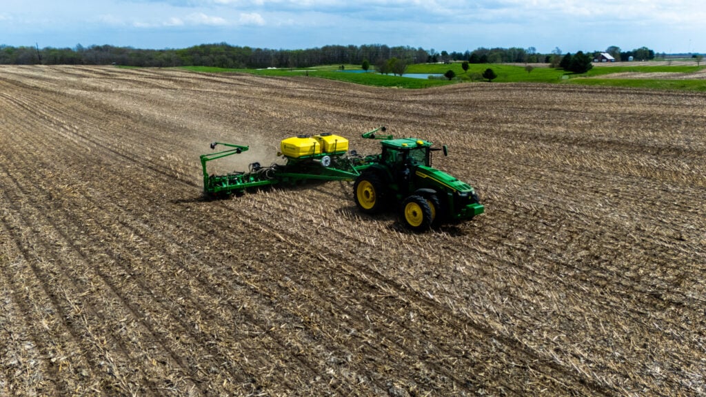
It’s mid-April in West Central Illinois, and spring planting season is in full swing. Across Morgan County, Scott County, and the surrounding farmland near Jacksonville, tractors are running from dawn to dusk, cultivating fields, pulling planters through corn stubble, and getting seed in the ground before the weather window closes. We were out there yesterday with our drone, and the perspective from 200 feet above tells a story that ground-level photos simply cannot.
Agricultural drone photography is more than just cool overhead shots. For farmers, ag equipment dealers, seed companies, co-ops, and agribusinesses across Central Illinois, aerial imagery is becoming an essential tool for marketing, documentation, crop monitoring, and storytelling. And as a drone pilot who grew up in this part of Illinois, there’s nothing quite like capturing the scale and precision of a modern planting operation from the air.
Why Agricultural Operations Need Drone Photography
Farming in West Central Illinois is a massive operation. The fields stretching across Morgan County, Scott County, Cass County, Greene County, and Pike County produce some of the most productive corn and soybean yields in the country. But from the cab of a tractor or the edge of a field, it’s impossible to see the full picture.
That’s where agricultural drone photography changes the game. An aerial perspective reveals things the human eye at ground level never could:
- Field coverage patterns: Are your passes overlapping? Are there gaps? From above, you can see exactly where the cultivator or planter has been and where it hasn’t
- Soil condition variation: Differences in moisture, compaction, and residue breakdown are dramatically visible from 100-400 feet up. Our photos from yesterday clearly show the contrast between freshly cultivated soil and unworked ground
- Equipment scale: A 60-foot field cultivator looks impressive from the road. From directly overhead, it’s genuinely stunning, and that’s the kind of image that stops someone from scrolling past your post
- Progress documentation: Drone shots create a visual timeline of planting progress that’s invaluable for farm management records, insurance documentation, and landowner updates
- Marketing content: Whether you’re a farm operation looking to attract investors, a co-op marketing your services, or an equipment dealer showcasing what your machines can do, aerial farm photography is the most compelling visual content you can produce
What Spring Planting Looks Like From 200 Feet Up
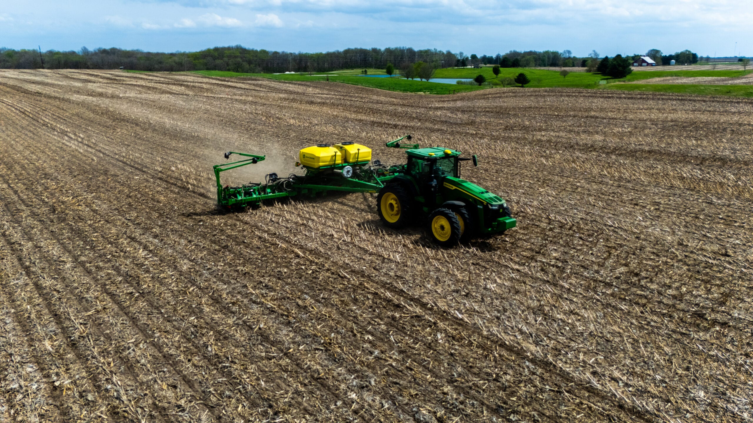
Yesterday’s shoot took place on the Scott/Morgan County border, about 12 minutes west of Jacksonville, IL. We captured two distinct phases of spring fieldwork: field cultivation (tillage to prep the seedbed) and planting (putting seed in the ground with a multi-row planter).
Field Cultivation
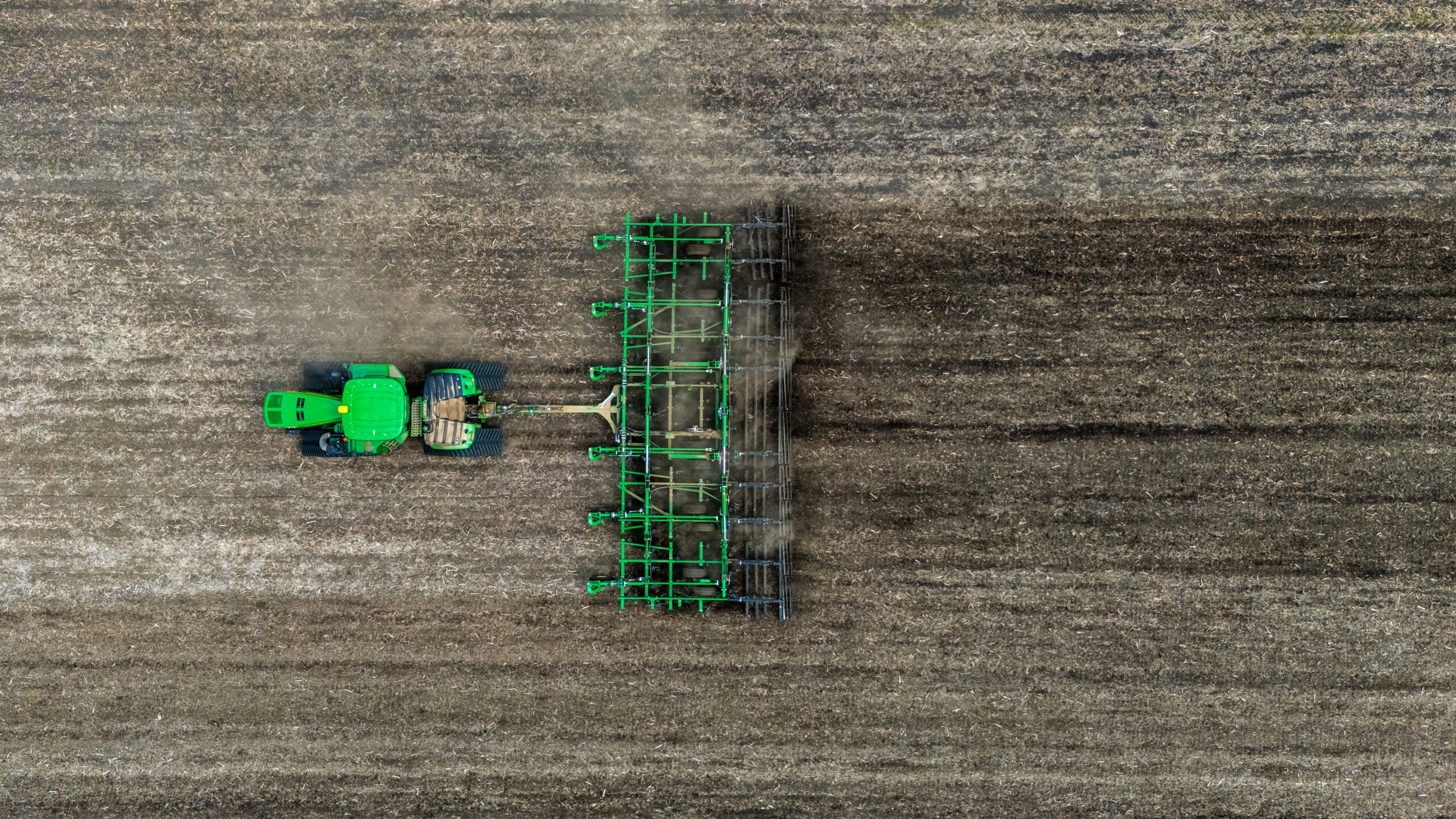
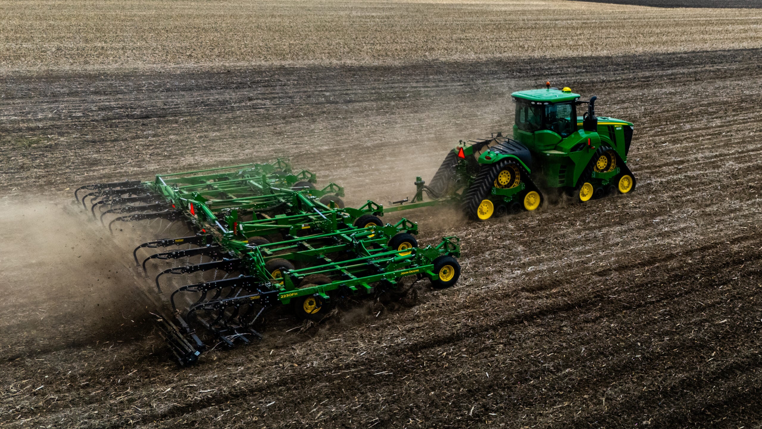
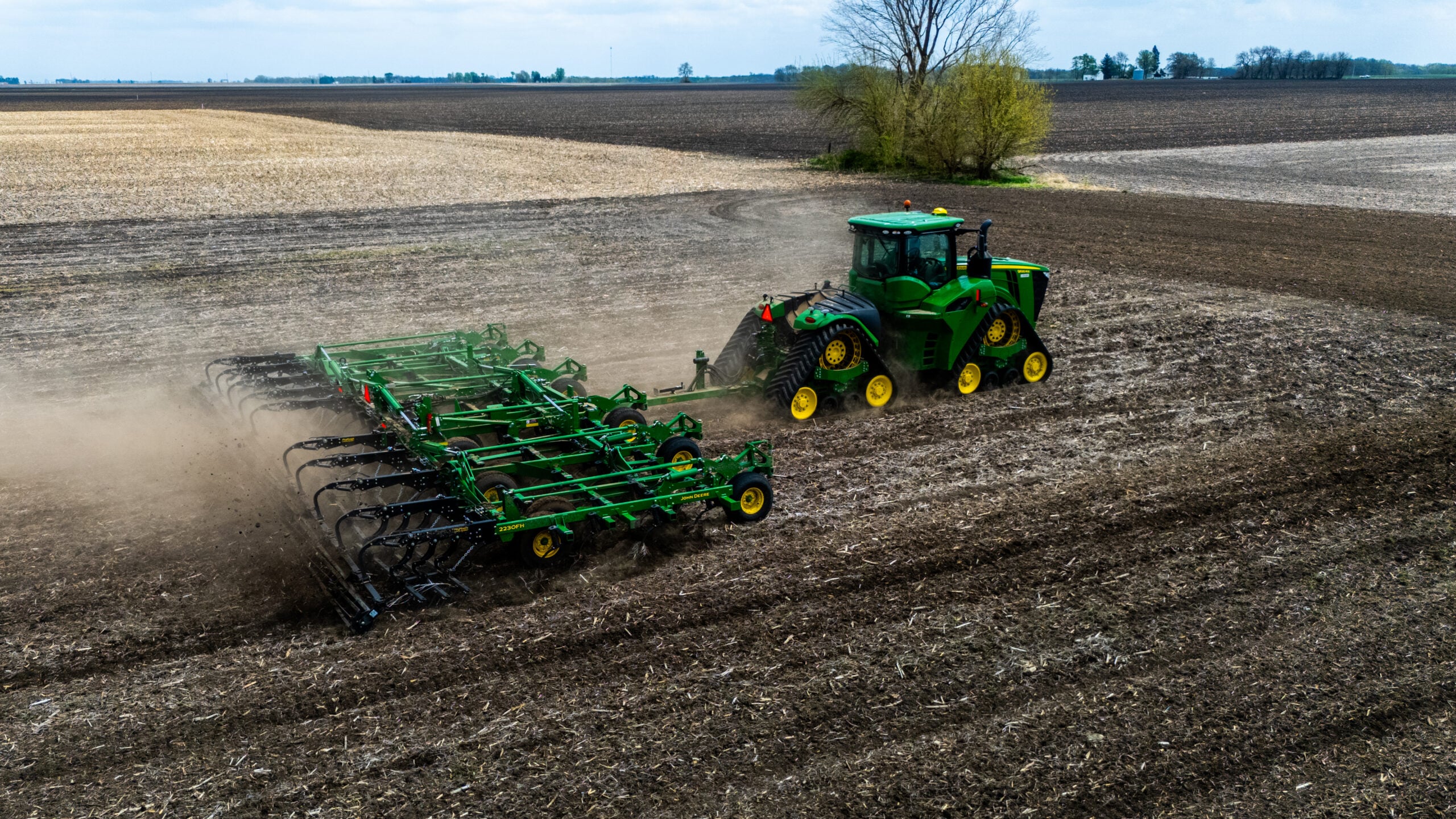
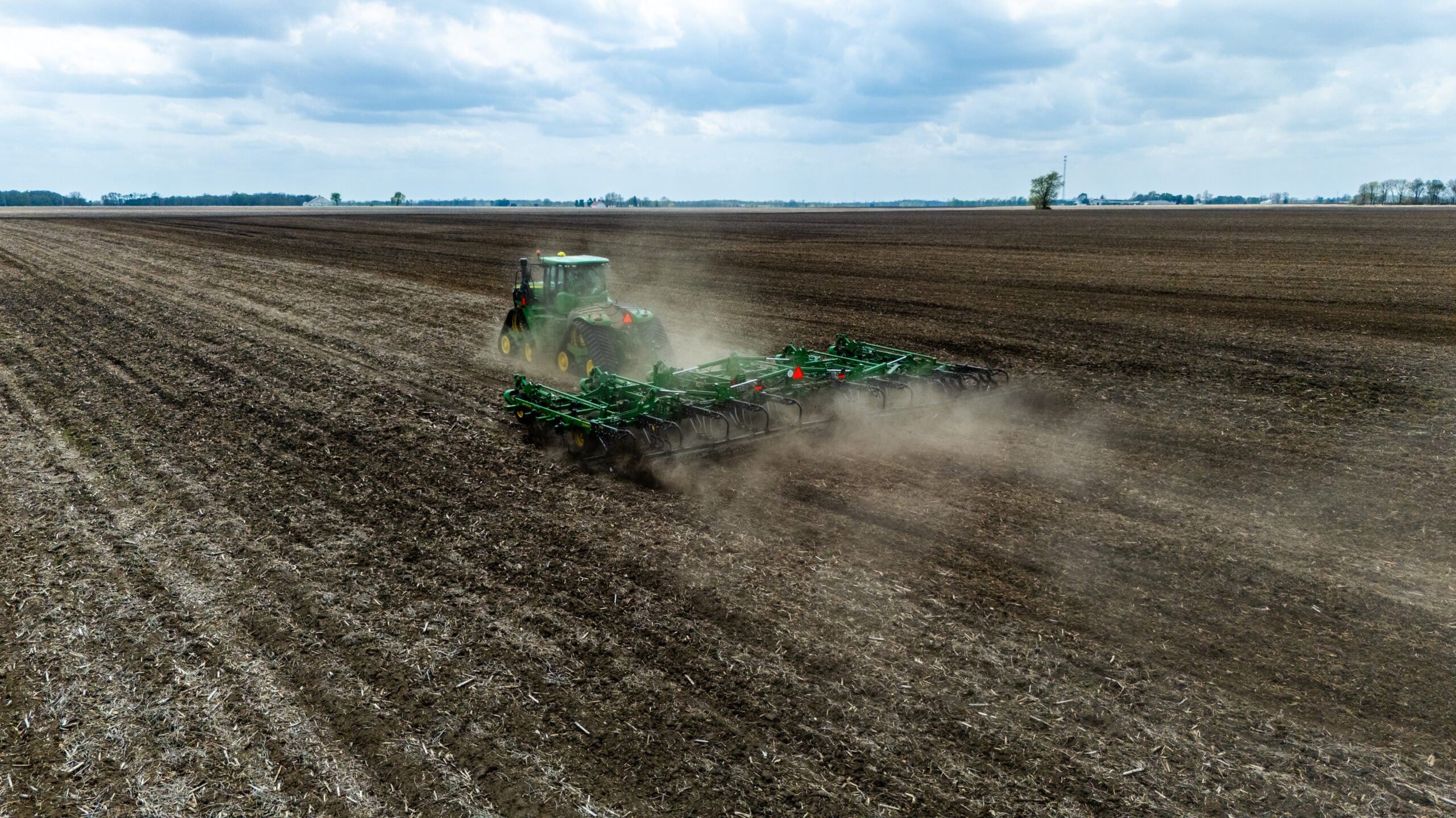
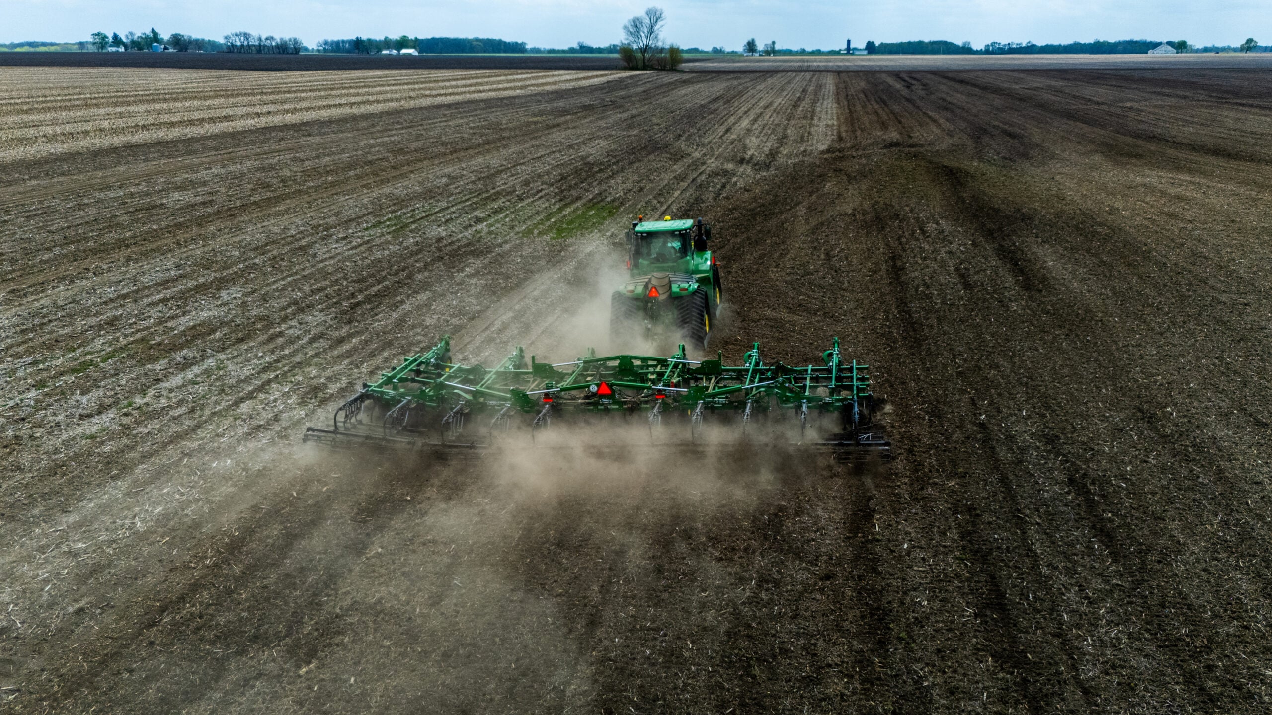
The first phase we documented was a large tractor pulling a field cultivator through rich, dark Illinois soil. From ground level, you see a tractor kicking up dust. From above, you see the geometry of the operation: the precise passes, the width of the implement, the texture difference between worked and unworked soil, and the sheer scale of the field stretching to the horizon.
The top-down perspective is especially powerful for tillage documentation. You can clearly see where the cultivator has been, how evenly the passes overlap, and whether any sections were missed. For farm managers overseeing operations across multiple fields, this kind of visual intelligence is more useful than any GPS map printout.
Planting
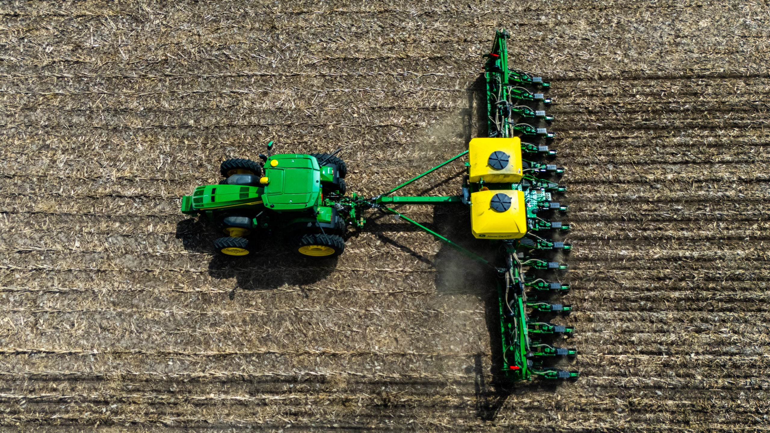
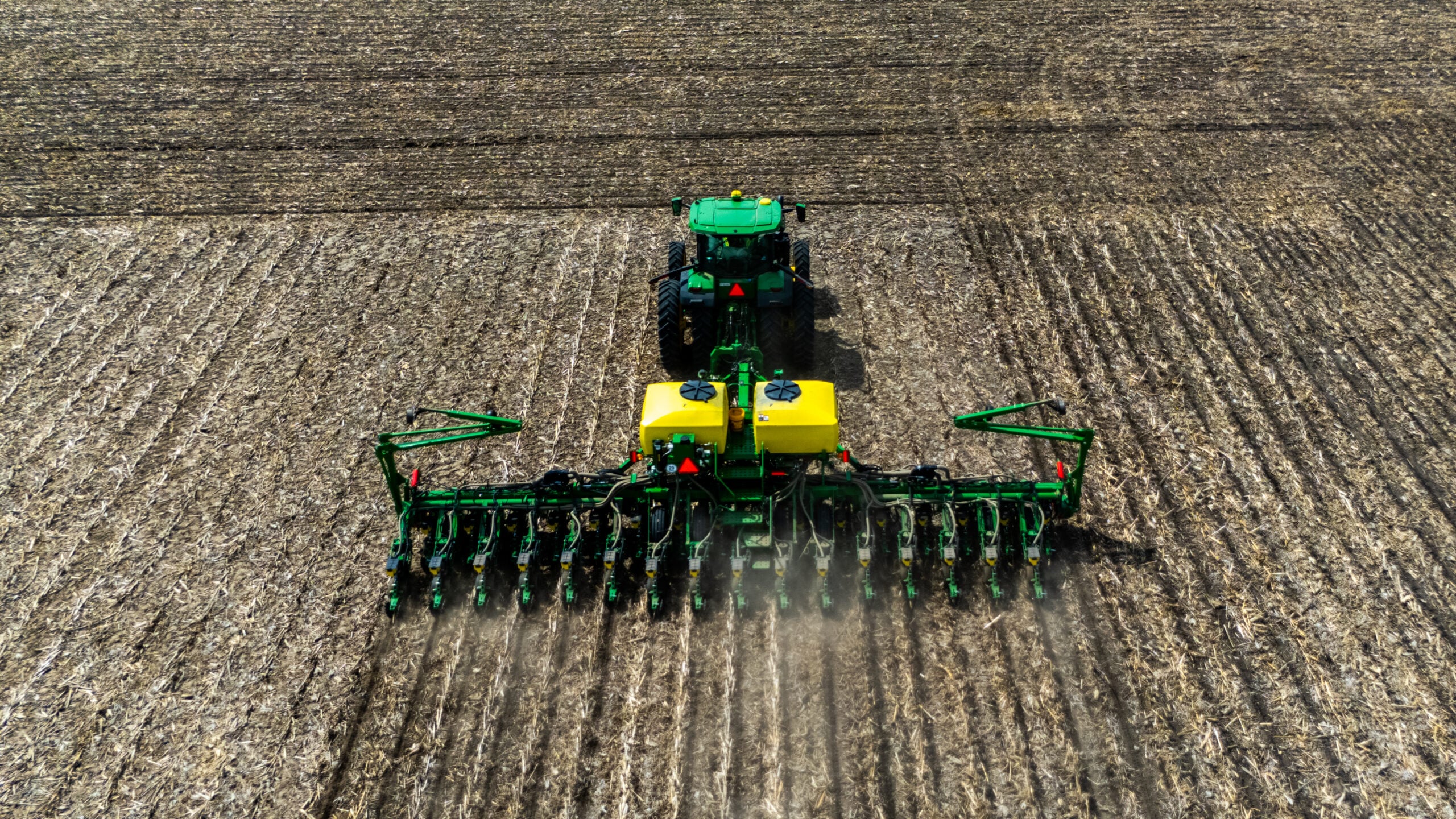
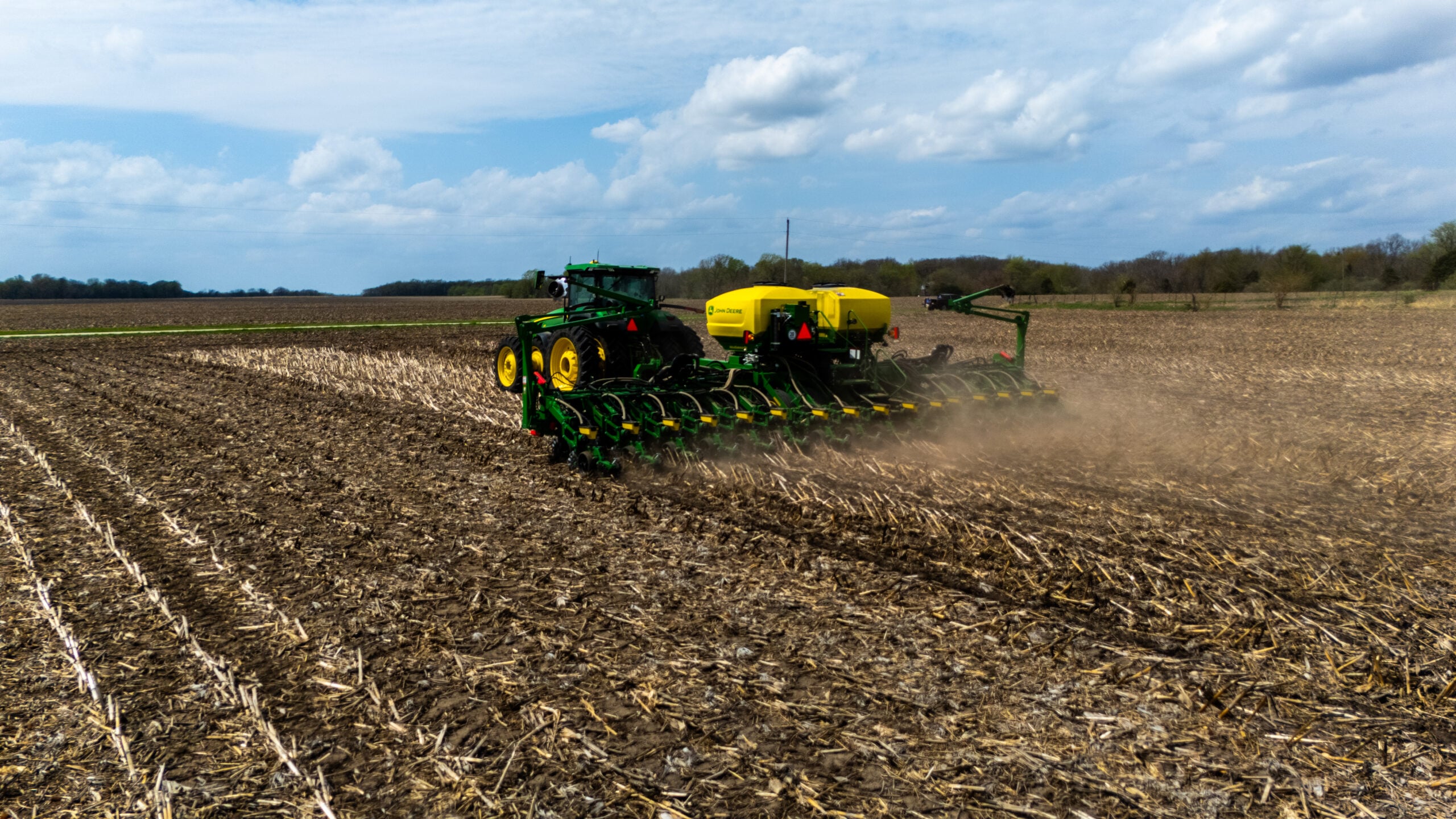
After field prep, we captured the planting operation: a tractor pulling a multi-row planter through corn stubble from the previous season. The yellow seed boxes, the green row units cutting through the residue, and the long straight rows of planted seed visible behind the machine tell the story of modern precision agriculture.
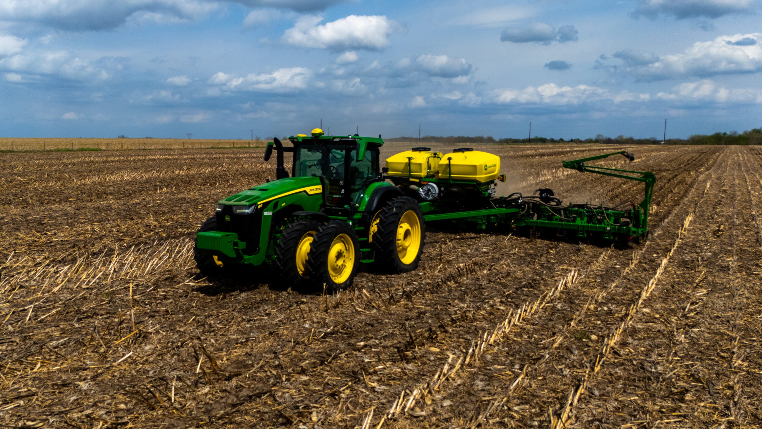
From a marketing standpoint, these images are gold. Equipment manufacturers, seed companies, and farm service providers spend thousands on stock photography that looks nothing like the actual fields their customers work in. These are real photos from real Central Illinois farmland, and that authenticity resonates with ag audiences in a way that generic stock images never will.
“From the cab, you see the row ahead of you. From 200 feet up, you see the whole operation, and that changes how you think about your farm.”
Who Benefits From Agricultural Drone Photography in Central Illinois
Agricultural drone photography isn’t just for farmers. The ag industry in West Central Illinois is a massive ecosystem, and aerial imagery serves almost every part of it:
- Farm operations: Document field conditions, planting progress, crop emergence, and harvest for your own records, landowner reports, and insurance claims. Operations across Morgan, Scott, Cass, Schuyler, and Greene counties can benefit from seasonal aerial documentation
- Ag equipment dealers: Nothing sells a combine, planter, or sprayer like seeing it work in the field from the air. Aerial video of equipment in action is the most engaging content you can put on your social media or website
- Seed and chemical companies: Drone imagery documenting crop performance through the growing season provides powerful testimonial content for your products. Side-by-side aerial comparisons of treated vs. untreated fields tell a visual story that data tables alone cannot
- Grain elevators and co-ops: Aerial photos of your facilities, truck lines at harvest, and the surrounding farmland you serve make compelling marketing materials and Google Business Profile content
- Farm real estate: Selling farmland without aerial photography in 2026 is like listing a house without interior photos. Buyers want to see field layouts, drainage patterns, access roads, and surrounding terrain from above before they’ll schedule a visit
- Agritourism and farm events: Corn mazes, pumpkin patches, farm-to-table events, and u-pick operations all benefit from aerial imagery that showcases the scale and setting of the experience
- Crop insurance adjusters: Drone photography provides time-stamped, geo-referenced visual documentation of field conditions that supports crop insurance claims with hard evidence
The Aerial Perspective: What Ground Photos Miss
Let’s be direct about this: you cannot replicate what a drone sees with a camera held at ground level. Even the best DSLR or smartphone photo taken from the edge of a field captures a flat, compressed view that makes a 160-acre operation look like a small patch of dirt.
Here’s what our drone captured yesterday that no ground camera could have:
- The soil texture contrast: Our top-down shots clearly show the difference between freshly cultivated soil and untouched ground. From the field edge, it all looks the same shade of brown
- Implement geometry: The field cultivator’s full 60+ foot width is only visible from directly above. From the ground, you see a fraction of the implement
- Row precision: The planter rows stretching behind the tractor demonstrate the precision of modern ag equipment in a way that’s visually striking from 200 feet up
- Landscape context: The tree lines, farmsteads, grain bins, and neighboring fields that frame the operation provide geographic context that makes the image feel rooted in a specific place: this part of Illinois, this farm, this season
- Scale: When you can see the tractor and implement as a small element within a vast field, the viewer instinctively understands the scope of modern farming. That emotional response is what makes aerial ag content so shareable
“The top-down shot of the cultivator is the image that makes people stop scrolling. You can see every pass, every row, every detail of the soil. That’s the power of the aerial perspective.”
How Ag Businesses Can Use Drone Content for Marketing
Capturing drone photos is step one. Turning them into marketing assets that generate leads and build your brand is where the real value lives. Here’s how agricultural businesses in the Jacksonville area and West Central Illinois can put aerial content to work:
GOOGLE BUSINESS PROFILE
Your Google Business Profile is often the first thing potential customers see. For ag businesses, aerial photos of your operation, facilities, or fieldwork set you apart from competitors using generic logos or outdated ground-level snapshots. Google rewards profiles with original, high-quality photography, and drone images are inherently original.
WEBSITE HERO IMAGERY
Your website’s hero banner gets 3 seconds to make an impression. An aerial shot of your operation during planting or harvest communicates scale, professionalism, and authenticity instantly. Compare that to a stock photo of a generic tractor in a field that could be anywhere.
SOCIAL MEDIA CONTENT
Aerial farm content consistently outperforms ground-level posts on social media. The perspective is inherently eye-catching, and agricultural audiences in particular engage with content that shows the reality of modern farming operations. Drone video clips of planting and harvest are among the most shared agricultural content on Facebook and Instagram.
SEASONAL DOCUMENTATION
A series of drone flights throughout the growing season (spring tillage, planting, emergence, mid-season growth, and harvest) creates a visual timeline of your operation that’s powerful for year-end reports, investor presentations, and social media storytelling.
Serving West Central Illinois: Morgan County and Beyond
Elevated Ideas is based in the heart of the region we serve. We’re not a drone company flying in from Chicago or St. Louis. We’re local, we know the landscape, and we understand the agricultural community that drives the economy in this part of Illinois.
Our drone photography and video services cover the full West Central Illinois agricultural corridor:
- Morgan County: Jacksonville, Waverly, Woodson, Meredosia, and the surrounding farmland
- Scott County: Winchester, Bluffs, Naples, and the rich bottomland and upland fields
- Cass County: Virginia, Beardstown, Chandlerville, and the Illinois River valley farmland
- Greene County: Carrollton, White Hall, Roodhouse, and the rolling agricultural landscape
- Pike County: Pittsfield, Barry, Griggsville, and the diverse farming operations along the Illinois River
- Schuyler County: Rushville and the surrounding agricultural operations
- Sangamon County: Springfield, Chatham, Auburn, and all of Sangamon County’s farming community
- Macoupin County: Carlinville, Staunton, Gillespie, and the agricultural heartland of southern Central Illinois
Every flight is conducted by an FAA Part 107 certified pilot with full liability insurance. We understand the airspace, the weather patterns, and the operational realities of flying near active agricultural operations. For more detail on drone regulations and what to expect, check out our complete guide to drone photography permits and pricing in Central Illinois.
Beyond Marketing: Practical Applications of Ag Drone Imagery
While marketing is the most visible use case, agricultural drone photography has practical operational applications that are equally valuable for Central Illinois farming operations:
Crop Scouting and Monitoring
Regular drone flights during the growing season reveal crop stress, nutrient deficiencies, weed pressure, and drainage issues before they become visible from the ground. A single flight over a quarter section can identify problem areas that would take hours to walk.
Drainage Assessment
Aerial photography after rain events reveals standing water patterns, tile line failures, and waterway erosion that guide drainage investment decisions. In the flat terrain of Morgan and Scott counties, drainage is everything, and aerial imagery makes drainage patterns visible in ways that ground observation simply cannot.
Livestock and Facility Management
Aerial views of grain storage, livestock facilities, and farmsteads help with layout planning, fence line assessment, and facility maintenance. For operations considering expansion, drone imagery provides a comprehensive visual baseline of existing infrastructure.
Crop Insurance Documentation
Time-stamped, geo-referenced aerial photos create an evidence trail that supports crop insurance claims. Documenting field conditions before, during, and after weather events provides adjusters with the visual context they need to process claims accurately and efficiently.
Land Valuation and Real Estate
Farmland buyers and appraisers increasingly expect aerial imagery. Drone photos showing field boundaries, soil variation, improvements, and surrounding land use help buyers make informed decisions and often accelerate the sales process. Listings with aerial photography consistently generate more inquiries than those without.
Related reading: More aerial work from across the region: our full Morgan County Fair 2025 drone recap.
Need Agricultural Drone Photography?
Whether you’re documenting spring planting, building marketing content for your ag business, or need aerial imagery for farm real estate, we’re local, FAA certified, and ready to fly.
FAA Part 107 certified, fully insured, and serving Jacksonville, Morgan County, and all of West Central Illinois.
COMMON QUESTIONS
Agricultural Drone Photography FAQ
How much does agricultural drone photography cost in Central Illinois?
Agricultural drone photography sessions in the Jacksonville and West Central Illinois area typically range from $200 to $600 depending on the scope of the project. A single-field planting or harvest documentation session is on the lower end, while a multi-field seasonal documentation package that includes multiple flights throughout the growing season will be higher. Compared to the cost of satellite imagery subscriptions or hiring a manned aircraft, drone photography is significantly more affordable and delivers higher-resolution imagery. Contact Elevated Ideas for a custom quote based on your specific needs.
Can drones fly over active farming operations safely?
Yes, with proper planning and an experienced pilot. FAA Part 107 certified drone pilots are trained in flight planning, risk assessment, and operational safety. We coordinate with the farm operator before every flight, maintain safe distances from equipment and personnel, and monitor weather conditions continuously. We’ve documented active planting, tillage, spraying, and harvest operations without any safety incidents. The key is communication with the equipment operator and maintaining situational awareness throughout the flight.
What’s the best time of year for agricultural drone photography in Illinois?
Every season has unique aerial opportunities. Spring tillage and planting (April-May) captures the dramatic transformation of bare fields into planted crop. Early summer (June-July) is ideal for crop scouting and documenting emergence and early growth. Mid-summer (July-August) shows crops at their peak, with lush green canopies visible from the air. Fall harvest (September-November) delivers the most dramatic content, with combines, grain carts, and semi trucks creating dynamic visual stories. Winter is ideal for drainage assessment and farmstead documentation when fields are bare.
Do I need to get permission to fly a drone over farmland?
Drone operators need permission from the landowner or tenant to launch and recover from private property, but FAA regulations govern the airspace above the land. All commercial drone flights require FAA Part 107 certification. In areas near airports or restricted airspace, additional LAANC authorization may be required. Elevated Ideas handles all regulatory requirements. You just need to grant us access to your property and we handle the rest, including flight planning, airspace authorization, and compliance documentation.
What kind of drone do you use for agricultural photography?
We use commercial-grade DJI drones equipped with high-resolution cameras capable of capturing detailed still photography and 4K video. These platforms offer GPS-stabilized flight, obstacle avoidance, and the ability to operate in the moderate wind conditions common across the flat Central Illinois landscape. For agricultural applications, we typically fly at altitudes between 100 and 400 feet, adjusting based on the field size and the type of imagery needed. Higher altitudes provide broader field coverage, while lower passes capture equipment and soil detail.
Can drone photos help sell farmland?
Absolutely. Aerial photography is one of the most impactful tools in farm real estate marketing. Drone images show potential buyers the full layout of a property: field boundaries, drainage patterns, timber, outbuildings, road access, and proximity to grain elevators or markets. In the competitive Central Illinois farmland market, listings with professional aerial imagery generate more inquiries and often sell faster. We work with farm real estate agents and landowners across Morgan, Scott, Cass, Greene, Pike, and surrounding counties to produce listing-ready aerial content.
How quickly do I get my drone photos and video after the shoot?
For standard agricultural photography sessions, edited photos are typically delivered within 2-3 business days. Video content that requires color grading, editing, and music may take 3-5 business days. For time-sensitive documentation like crop insurance claims or weather event damage assessment, we offer expedited turnaround. All deliverables are provided in high-resolution formats suitable for web, print, and social media use.
Do you offer seasonal drone photography packages for farms?
Yes. Our seasonal documentation packages include scheduled flights throughout the growing season, typically covering spring tillage, planting, mid-season crop development, and harvest. This creates a comprehensive visual record of your operation over the full growing cycle. Seasonal packages are priced at a discount compared to individual session bookings and are ideal for farm operations that want consistent aerial documentation for management records, marketing content, and landowner reporting. Contact us for seasonal package pricing specific to your operation’s needs.
Written by Ryan Mason, Founder of Elevated Ideas, FAA Part 107 certified drone pilot and digital marketing strategist serving Jacksonville IL, Morgan County, Scott County, and all of West Central Illinois. April 2026.