
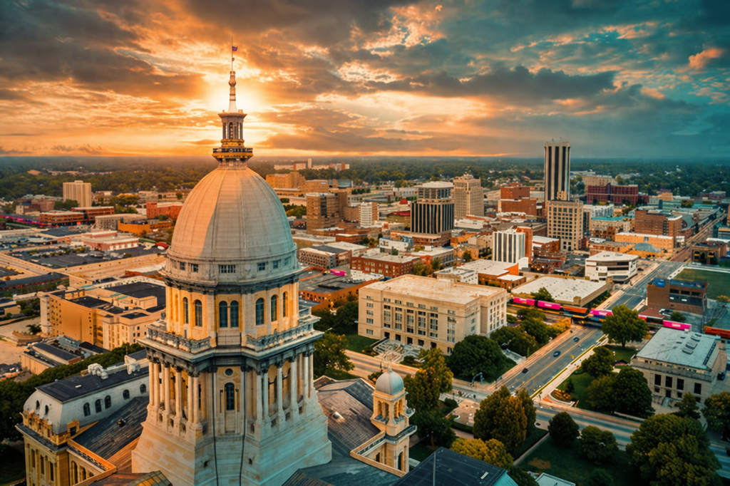
Need hands-on help nearby? Explore our video marketing in Springfield IL.
Whether you are a real estate agent trying to sell a lakefront property, a roofing company showcasing your latest project, or a wedding venue wanting to capture the full beauty of your grounds, drone photography in Springfield IL has become one of the most powerful visual marketing tools available. Aerial imagery grabs attention in ways that ground-level photos simply cannot. But before you hire a drone photographer or try to fly one yourself, you need to understand the regulations, typical costs, and what the process actually looks like from start to finish. This complete guide covers everything you need to know about drone photography in Springfield, Illinois, and across the Central IL region.
FAA Regulations for Drone Photography
The Federal Aviation Administration governs all drone operations in the United States, and drone photography is no exception. Whether you are hiring a professional or considering doing it yourself, understanding these rules is essential. Violating FAA regulations can result in fines up to $27,500 for civil penalties and up to $250,000 with possible imprisonment for criminal violations.
Key FAA Requirements for Commercial Drone Photography
- Part 107 Remote Pilot Certificate: Any drone photography done for commercial purposes (including real estate listings, business marketing, construction documentation, or any work you are paid for) requires the drone operator to hold an FAA Part 107 Remote Pilot Certificate. This involves passing a 60-question knowledge test covering airspace, weather, regulations, and flight operations. The certificate must be renewed every 24 months through a recurrent knowledge test.
- Drone Registration: All drones weighing between 0.55 lbs and 55 lbs must be registered with the FAA. Each drone receives a unique registration number that must be displayed on the aircraft. Registration costs $5 and is valid for three years.
- Remote ID: As of March 2024, all drones operated in U.S. airspace must comply with Remote ID requirements. This broadcasts the drone’s identification, location, altitude, and control station location. Most modern drones have Remote ID built in, but older models may need a Remote ID broadcast module.
- Visual Line of Sight (VLOS): The pilot must maintain visual line of sight with the drone at all times during flight. This means the operator must be able to see the drone without binoculars or other vision-enhancing devices.
- Altitude Limit: Drones may not fly above 400 feet above ground level (AGL) unless they are within 400 feet of a structure, in which case they can fly up to 400 feet above the structure’s highest point.
- Daylight Operations: Flights must occur during civil twilight or later unless the drone is equipped with anti-collision lighting visible for at least 3 statute miles.
- No Flying Over People: Standard Part 107 prohibits flying over people who are not directly participating in the operation, though waivers can be obtained for certain categories of small drones.
When you hire a professional drone photographer in Springfield IL, always ask to see their Part 107 certificate. Any legitimate operator will have it readily available and should not hesitate to share proof of certification. If someone offers drone photography services without holding a Part 107 certificate, they are operating illegally, and both the pilot and the client can face penalties.
Springfield IL Airspace Considerations
Springfield, Illinois, presents some unique airspace challenges that every drone photographer needs to understand. The city sits within the airspace of Abraham Lincoln Capital Airport (SPI), which is a towered airport with controlled airspace that extends over much of the Springfield metro area.
Springfield-Specific Airspace Rules
- Abraham Lincoln Capital Airport (SPI) Class D Airspace: The airport’s Class D airspace extends from the surface to approximately 2,700 feet MSL within a roughly 4.5-nautical-mile radius of the airport. Any drone operation within this airspace requires prior authorization. Many popular Springfield locations, including commercial districts, residential neighborhoods, and parks, fall within this controlled airspace.
- LAANC Authorization: The Low Altitude Authorization and Notification Capability (LAANC) system allows drone pilots to request and receive near-real-time authorization to fly in controlled airspace. Through LAANC, pilots can submit requests via approved apps like Aloft, Airmap, or DroneUp. Authorizations are typically processed automatically in seconds based on the FAA’s UAS Facility Maps, which define the maximum altitude approved for each grid cell near the airport.
- State Capitol Complex Restrictions: The Illinois State Capitol complex and surrounding government buildings in downtown Springfield are sensitive areas. While there is no permanent Temporary Flight Restriction (TFR) over the capitol, pilots should check NOTAMs (Notices to Air Missions) before every flight, as TFRs are frequently issued during legislative sessions, special events, and VIP visits. When the governor or other high-profile officials are present, TFRs can be issued with little notice.
- Lincoln Presidential Library and Museum Area: High-traffic tourist areas in downtown Springfield require extra caution and may have additional local restrictions. Always verify current rules before flying.
- Parks and Recreation Areas: Some Springfield-area parks may have their own rules regarding drone operations. Lake Springfield, for example, is a popular location for aerial photography but requires awareness of nearby airport traffic patterns and any local ordinances.
For drone photography projects outside Springfield proper (in places like Chatham, Rochester, Sherman, or rural Sangamon County), airspace restrictions are generally more relaxed. However, pilots must still check for TFRs and any nearby airports or heliports. The surrounding Central Illinois counties have multiple small airports and agricultural airstrips that create their own airspace considerations.
A professional drone photographer in Springfield IL will handle all airspace authorizations before your shoot. If your operator does not mention airspace clearance, ask about it. This is not optional. It is a legal requirement.
Drone Photography Pricing Guide for Central IL
One of the most common questions people ask is how much drone photography costs in Springfield IL and across Central Illinois. Pricing varies based on the type of project, the deliverables, and the experience of the photographer. Here is a realistic breakdown of what you can expect to pay in the Central IL market.
Typical Drone Photography Pricing in Central Illinois
- Per Hour Rate: Most professional drone photographers in the Springfield and Central IL area charge between $150 and $400 per hour. This typically includes the pilot’s time, equipment, travel within the local area, and basic editing. Highly experienced operators with advanced equipment and FPV capabilities may charge more.
- Real Estate Photography Package: A standard real estate drone photography package (10-20 exterior aerial photos plus basic editing) ranges from $150 to $350 per property. Packages that include interior photography, video flyovers, and virtual tours can run $400 to $1,200.
- Commercial Video Production: Full drone video production for businesses (including pre-production planning, multiple flight sessions, professional editing, color grading, and music licensing) typically ranges from $500 to $3,000+ depending on complexity and length of the final edit.
- Construction and Progress Documentation: Recurring drone documentation for construction sites is often priced as a monthly retainer, typically $300 to $800 per month for bi-weekly or monthly flights with standardized deliverables.
- Event Coverage: Drone coverage for events such as festivals, outdoor weddings, or community gatherings typically runs $300 to $800 for 2-4 hours of coverage with edited highlights.
- Agricultural and Land Survey Imagery: Aerial mapping and agricultural imaging for farmland in Central Illinois ranges from $200 to $600 depending on acreage and the type of data collected (standard photos vs. NDVI mapping vs. orthomosaic maps).
- FPV (First Person View) Cinematic Footage: FPV drone footage (the fast, immersive, cinematic style that flies through and around structures) is a premium service. Expect to pay $500 to $2,000+ per session due to the specialized equipment and high skill level required.
When comparing drone photography pricing in Illinois, be cautious of extremely low prices. Operators charging $50 to $75 per shoot are likely cutting corners on insurance, may not hold a Part 107 certificate, or may be using consumer-grade equipment that produces lower quality results. The value of professional aerial photography comes from the combination of legal compliance, proper insurance, professional equipment, and editing expertise.
What to Expect During a Drone Shoot
If you have never hired a drone photographer before, here is what a typical drone photography session looks like from pre-flight planning through final delivery.
Pre-Flight Planning
A professional drone photographer will plan your shoot well before showing up on location. This phase includes:
- Location Scouting: Reviewing satellite imagery, Google Earth, and sometimes visiting the location in advance to identify the best angles, potential obstacles (power lines, trees, tall structures), and ideal launch and landing zones.
- Airspace Check: Verifying airspace classifications, checking for active TFRs, and requesting LAANC authorization if operating near Abraham Lincoln Capital Airport or other controlled airspace in the Springfield area.
- Weather Assessment: Monitoring wind speed, precipitation, cloud cover, and visibility. Most professional drones can handle winds up to 25-30 mph, but ideal conditions are winds under 15 mph with clear or partly cloudy skies. Rain, snow, and fog are no-fly conditions for most operations.
- Shot List Development: Working with you to create a detailed list of the shots, angles, and compositions you need. This might include specific building perspectives, property boundary coverage, approach shots, or reveal shots for video content.
Day of the Shoot
On shoot day, here is the typical workflow:
- Equipment Setup: The pilot will arrive and set up their ground station, calibrate the drone’s compass and IMU, check battery levels, and perform a pre-flight safety checklist. This takes approximately 10-15 minutes.
- Safety Briefing: A professional operator will brief anyone on-site about safety protocols, including maintaining distance from the drone, the planned flight path, and what to do in case of an emergency.
- Flight Operations: The actual flying typically takes 30 minutes to 2 hours depending on the project scope. Battery swaps occur every 20-35 minutes depending on the drone model and conditions. Expect 2-5 flights for a standard photo shoot and 4-8 flights for comprehensive video projects.
- On-Site Review: Many photographers will review initial footage on a tablet or laptop before leaving to confirm they captured everything on the shot list. This is your opportunity to request additional angles or reshoot anything that does not look right.
Post-Production and Delivery
- Photo Editing: Raw drone photos undergo color correction, exposure adjustment, lens distortion correction, and cropping. Turnaround for edited photos is typically 2-5 business days.
- Video Editing: Video projects involve footage selection, color grading, stabilization, transitions, text overlays, and music. Turnaround for edited video ranges from 5-14 business days depending on complexity.
- Delivery Format: Final files are typically delivered via cloud sharing (Google Drive, Dropbox, or a custom client portal) in high-resolution formats ready for web, social media, and print use.
Types of Deliverables from Drone Photography
Modern drone technology can produce a wide range of visual content. Understanding the different types of deliverables helps you communicate exactly what you need from your drone photographer.
Drone Photography and Video Deliverable Types
- High-Resolution Still Photos: Standard aerial photographs shot in RAW or JPEG format at 20+ megapixels. These are ideal for website hero images, real estate listings, brochures, and print advertising.
- 4K Video (and Above): Cinematic aerial video captured at 4K (3840×2160) or higher resolution. Used for website background videos, social media content, YouTube channels, and broadcast-quality productions. Most professional drones now shoot in 4K at 60fps or even 5.1K.
- FPV Cinematic Footage: Immersive, fast-moving footage captured by FPV (First Person View) drones. This style creates a “flying through” effect that is incredibly engaging for business tours, venue showcases, and creative marketing content. See an example of drone video showcasing a campground property.
- Edited Highlight Reels: Polished, music-synced videos typically 60-90 seconds long that combine the best aerial clips into a compelling marketing piece. These are the deliverables that perform best on social media platforms.
- Raw Footage: Unedited video files and unprocessed photos delivered directly from the drone. Useful if you have your own editing team or want maximum flexibility with the content.
- Panoramic Photos: Multiple photos stitched together to create ultra-wide or 180-degree panoramic images. Excellent for showcasing large properties, landscapes, and development sites.
- 360-Degree Photos and Virtual Tours: Spherical photos that allow viewers to look in every direction from a single aerial vantage point. These can be embedded on your website or shared on platforms like Google Street View and Facebook.
- Orthomosaic Maps: Stitched aerial photos that create a geometrically corrected, high-resolution map of an area. Used for agriculture, construction, surveying, and land management.
Best Times and Seasons for Drone Photography in Central IL
Timing matters enormously for aerial photography. The quality of light, weather conditions, and seasonal landscapes all impact the final result. Here is what works best in the Central Illinois climate.
Optimal Timing for Aerial Photography
- Golden Hour (Sunrise and Sunset): The hour after sunrise and the hour before sunset produce the most dramatic and flattering aerial imagery. Long shadows add depth and dimension, and warm light makes properties and landscapes look their best. In Springfield IL, golden hour timing varies from about 6:00 AM in summer to 7:30 AM in winter for sunrise shoots.
- Overcast Days: Do not cancel a shoot just because it is cloudy. Overcast skies act as a giant softbox, producing even, shadow-free lighting that is excellent for real estate photography and construction documentation. These conditions also eliminate harsh shadows that can obscure architectural details.
- Midday (Avoid for Most Projects): The overhead sun between 11 AM and 2 PM creates harsh shadows and washed-out colors from above. The exception is straight-down mapping and survey work, where midday lighting minimizes shadows and produces the most accurate ground imagery.
Seasonal Considerations for Central Illinois
- Spring (March – May): Early spring can be challenging due to brown landscapes and unpredictable weather, but late April through May offers fresh green foliage and blooming trees. Spring storms and wind are common, so flexibility is important.
- Summer (June – August): Peak season for drone photography. Lush green landscapes, long daylight hours, and generally stable weather make this the most popular time. However, heat haze can reduce image clarity on extremely hot days, and summer thunderstorms can develop quickly in Central Illinois.
- Fall (September – November): Fall foliage in Central Illinois creates stunning aerial imagery, particularly in October when the maples, oaks, and hickories reach peak color. This is arguably the most photogenic season for aerial photography and the best time for real estate shoots featuring wooded lots or rural properties.
- Winter (December – February): Snow-covered landscapes can create dramatic, high-contrast aerial images. Winter is also ideal for commercial building inspections and roof surveys because bare trees eliminate obstructions. Cold weather does reduce battery performance by 20-30%, so flight times are shorter.
The best drone photos happen when preparation meets the right conditions. In Central Illinois, fall foliage and golden hour combine to produce aerial imagery that can transform a property listing or business marketing campaign.
How to Prepare Your Property for a Drone Shoot
Your drone photographer handles the technical side, but there are things you can do to ensure your property looks its best from the air. Aerial cameras see everything, including things you might not notice from the ground.
Property Preparation Checklist
- Mow and Edge the Lawn: Freshly cut grass with defined edges looks dramatically better from above. Mow in a clean pattern. Diagonal or striped mowing patterns photograph particularly well from aerial perspectives.
- Remove Vehicles and Clutter: Move cars, trash cans, portable basketball hoops, and any other items that detract from the property’s appearance. A clean driveway and yard make a significant difference in aerial photos.
- Clean the Roof and Gutters: Drone cameras will capture your roof in high resolution. Remove debris, clear leaves from gutters, and consider pressure washing if the roof has visible staining or moss.
- Stage Outdoor Spaces: If your property has a patio, deck, pool, or outdoor entertaining area, set it up as if guests were coming. Add patio furniture, open umbrellas, and create an inviting scene that drone cameras can capture from above.
- Coordinate with Neighbors: If possible, let adjacent property owners know about the shoot. While not legally required, it is courteous and can prevent unnecessary complaints or misunderstandings.
- Power Wash Driveways and Walkways: Concrete and pavement stains that are barely visible at eye level become very noticeable in high-resolution aerial photos. A quick power wash dramatically improves curb appeal from above.
- Trim Overhanging Branches: Trees that overhang rooflines or obscure key features of the property should be trimmed before the shoot. This improves both the aesthetic and the drone pilot’s operational safety.
Choosing a Drone Photographer in Springfield IL
Not all drone operators are created equal. The barrier to entry for buying a drone is low, but the gap between a hobbyist with a consumer drone and a professional aerial photographer is enormous. Here is what to look for when choosing a drone photographer for your project in Springfield or Central Illinois.
What to Look for in a Professional Drone Photographer
- FAA Part 107 Certification: This is non-negotiable. Ask to see their certificate and verify it is current. An uncertified operator puts both of you at legal risk.
- Liability Insurance: Professional drone operators carry aviation liability insurance, typically $1 million or more in coverage. Many commercial clients and property managers require proof of insurance before allowing drone operations on their property. Ask for a certificate of insurance.
- Portfolio and Demo Reel: Review their previous aerial work. Look for consistent quality, creative composition, smooth camera movements, and professional editing. A portfolio tells you more about quality than any sales pitch.
- Equipment Quality: Ask what drone platforms they use. Professional-grade drones from DJI (Mavic 3 Pro, Inspire 3, Air 3) offer dramatically better image quality, stability, and reliability than budget consumer models. Operators with multiple drone types, including FPV drones for cinematic work, offer more creative options.
- Experience with Your Project Type: A drone photographer who specializes in real estate may not be the best choice for a fast-paced event, and vice versa. Ask about their experience with projects similar to yours.
- Post-Production Capabilities: Capturing great aerial footage is only half the equation. Ask about their editing workflow, the software they use, and turnaround times. Professional post-production transforms good footage into exceptional marketing content.
- Communication and Professionalism: How quickly do they respond? Do they ask thoughtful questions about your project? Do they provide clear pricing and timelines? Professionalism before the booking is a strong indicator of professionalism during and after the shoot.
Related reading: See what flying over crowds and moving vehicles actually looks like: our Morgan County Fair 2025 aerial coverage (flown under an FAA over-people waiver).
Ready for Stunning Aerial Content?
Elevated Ideas provides professional drone photography and video throughout Springfield and Central Illinois. FAA Part 107 certified, fully insured, and equipped with both standard and FPV drones for every type of project.
FAA Part 107 Certified • Fully Insured • Springfield IL • Serving All of Central Illinois
Why Elevated Ideas Is the Top Choice in Springfield and Central IL
There are a handful of drone operators in the Springfield area, but Elevated Ideas stands apart for several reasons that go beyond just flying a drone and taking pictures.
What Sets Elevated Ideas Apart
- FAA Part 107 Certified and Fully Insured: We hold a current FAA Remote Pilot Certificate and carry comprehensive aviation liability insurance. We handle all airspace authorizations, LAANC requests, and regulatory compliance so you do not have to worry about it.
- Standard + FPV Drone Capabilities: We operate both standard professional drones for precise, stabilized aerial photography and FPV drones for immersive, cinematic footage. Very few operators in Central Illinois offer both. This means we can capture the wide establishing shots, the detailed property closeups, and the dynamic fly-through tours all in a single session. Watch an example of our cinematic work at Twisted Tree Music Hall.
- Marketing Integration: This is the biggest differentiator. Most drone photographers hand you a folder of files and walk away. At Elevated Ideas, drone photography is part of a complete content marketing strategy. We understand how aerial content should be optimized for your website, social media, Google Business Profile, and digital advertising campaigns because we provide those services too.
- Local Central Illinois Knowledge: We know the Springfield area airspace inside and out. We know which areas require LAANC authorization, where TFRs pop up around the state capitol, and the best seasonal timing for aerial photography in this region. Local knowledge saves time and produces better results.
- Quick Turnaround: Standard photo projects are delivered within 3 business days. Video projects within 7-10 business days. Rush turnaround is available for time-sensitive projects at an additional fee.
When you work with Elevated Ideas, you are not just hiring someone to fly a drone. You are partnering with a digital marketing agency that happens to have professional drone capabilities, which means every piece of aerial content is created with your marketing goals in mind from the very first shot.
How Drone Content Integrates with Your Marketing Strategy
The real ROI of drone photography comes not from the footage itself, but from how strategically you deploy it across your marketing channels. Aerial content is incredibly versatile when you have a plan for using it effectively.
Drone Content Across Your Marketing Channels
- Website: Aerial photos and video make stunning hero sections, background videos, and gallery elements on your website. A drone flyover video as your homepage hero immediately communicates professionalism and scale. Properties with aerial photos receive 68% more views than those with ground-level photos only.
- Social Media: Aerial content consistently outperforms ground-level imagery on social platforms. Instagram Reels and TikToks featuring drone footage generate 3-5x more engagement than standard business posts. A strategic social media management plan that incorporates aerial content keeps your feed dynamic and scroll-stopping.
- Google Business Profile: Adding aerial photos and short drone videos to your Google Business Profile makes your listing dramatically more engaging. Businesses with rich visual content on GBP receive significantly more direction requests, website clicks, and phone calls.
- Digital Advertising: Drone footage used in Facebook ads, Instagram ads, and YouTube pre-roll performs exceptionally well because aerial perspectives are inherently attention-grabbing in a crowded feed. The novelty factor of aerial views earns longer watch times and higher click-through rates.
- Email Marketing: An aerial photo of your business or property as the header image in an email campaign increases open-to-click rates. It is visually compelling and immediately differentiates your emails from competitors using stock photography.
- Print and Signage: High-resolution aerial photos translate beautifully to large-format printing (banners, billboards, brochures, and direct mail pieces). An aerial perspective on a real estate brochure or a construction company’s portfolio piece makes a powerful first impression.
The key is having a marketing partner who understands both the drone photography side and the digital marketing side. When your content marketing strategy is built around high-quality aerial assets, every channel benefits from more engaging, more professional visual content.
Drone photography is not just about getting pretty pictures from above. It is a marketing investment that pays dividends across every channel, from your website and social media to your Google Business Profile and paid advertising campaigns.
Frequently Asked Questions
Drone Photography in Springfield IL
How much does drone photography cost in Springfield IL?
Drone photography pricing in Springfield and Central Illinois typically ranges from $150 to $400 per hour for professional operators. Real estate packages start around $150-$350, while comprehensive commercial video projects range from $500 to $3,000+ depending on scope, editing requirements, and the type of footage needed. FPV cinematic footage is a premium service that typically costs $500-$2,000 per session. Always confirm that pricing includes a Part 107 certified pilot, insurance, and professional editing.
Do I need a permit for drone photography in Springfield, Illinois?
If the drone photography is for any commercial purpose, the pilot must hold an FAA Part 107 Remote Pilot Certificate. In Springfield specifically, much of the city falls within the Class D airspace of Abraham Lincoln Capital Airport, which requires LAANC authorization before flying. Additionally, pilots should always check for Temporary Flight Restrictions near the State Capitol complex. A professional drone photographer will handle all of these authorizations as part of their service.
What is the best time for aerial photos in Illinois?
The best time of day for aerial photography is during golden hour: the first hour after sunrise and the last hour before sunset. The warm, angled light creates depth and makes properties look their best. For seasonal timing, late spring through early fall offers the lushest landscapes, while October provides stunning fall foliage. Overcast days are also excellent for real estate and commercial photography because the soft, even lighting eliminates harsh shadows. Avoid midday shoots when possible, as the overhead sun washes out colors and creates unflattering shadows.
How long does a drone photo shoot take?
A standard drone photography session for real estate or a small business takes approximately 30 minutes to 1 hour of actual flight time, plus 15-20 minutes for setup and safety checks. More complex projects involving multiple locations, video production, or comprehensive property coverage may take 2-4 hours. Battery changes every 20-35 minutes are normal. Post-production turnaround is typically 2-5 business days for photos and 5-14 business days for edited video.
Can drones fly in winter in Central Illinois?
Yes, drones can fly in winter conditions in Central Illinois, and snow-covered landscapes can produce dramatic aerial imagery. However, cold weather reduces battery performance by 20-30%, which means shorter flight times. Professional operators pre-warm batteries and plan for more frequent battery swaps. Winter is actually an excellent time for commercial building inspections and roof surveys because bare trees eliminate visual obstructions. Flights should be avoided during active precipitation, ice storms, or when temperatures drop below the drone manufacturer’s operating limits (typically around 14 degrees F for most professional drones).
What is FPV drone footage and is it worth it?
FPV stands for First Person View, and it refers to a style of drone flying where the pilot wears goggles and flies the drone manually with a much more dynamic, immersive perspective. FPV drones can fly through doorways, around obstacles, and create the “flying through a building” effect that standard drones cannot replicate. FPV footage is exceptionally engaging for social media and website content, particularly for venue tours, business walkthroughs, and creative marketing pieces. It costs more than standard drone photography because it requires specialized equipment and a high level of piloting skill, but the visual impact is unmatched for the right project.
Do I own the drone photos and videos after the shoot?
This depends on the agreement with your drone photographer. Most professional operators grant full commercial usage rights to the client upon final payment, meaning you can use the content across all your marketing channels without restrictions. However, many photographers retain the right to use the imagery in their own portfolio. At Elevated Ideas, we provide full commercial usage rights with every project. You own your content and can use it however you see fit across your website, social media, advertising, and print materials.
How do I use drone content in my marketing?
Drone photography and video should be deployed across all of your marketing channels for maximum ROI. Use aerial photos as hero images on your website, share drone video clips as Instagram Reels and TikToks, upload aerial images to your Google Business Profile, and incorporate aerial footage into digital ad campaigns. Aerial content consistently outperforms ground-level imagery in engagement metrics across social media and advertising. The key is working with a marketing partner who can help you integrate aerial assets into a cohesive content strategy rather than just handing you a folder of files.
Get Professional Drone Photography in Springfield IL
From real estate aerials to cinematic FPV tours, Elevated Ideas delivers the aerial content your business needs to stand out. FAA certified. Fully insured. Marketing-focused.
To see an indoor FPV tour in a historic building, watch our one-take flight through Jacksonville Transfer Company @ The Gillham House, the antique mall and salvage shop in Jacksonville.
Elevated Ideas LLC • Springfield, IL • Serving Central Illinois & Beyond
Written by Ryan Mason
Founder of Elevated Ideas • FAA Part 107 Certified Drone Pilot • Digital marketing strategist serving Springfield, IL and Central Illinois businesses